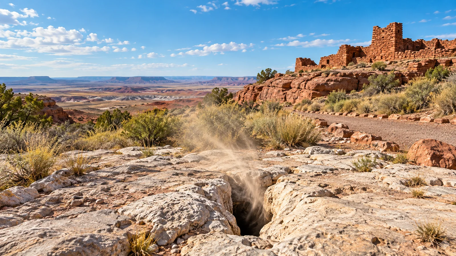
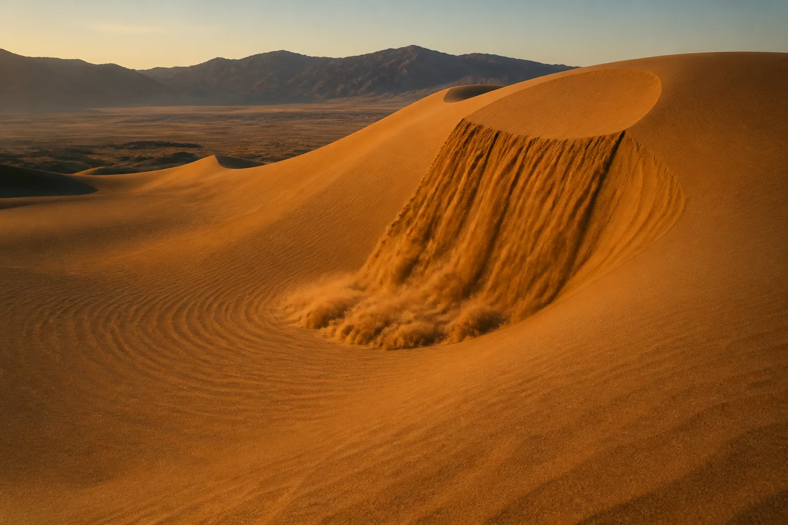
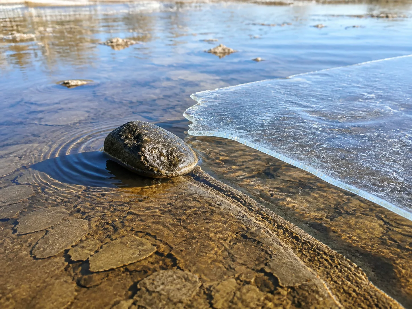
Editorial illustration: A high-desert view inspired by Wupatki National Monument’s natural blowhole landscape.
At the end of the trail behind Wupatki National Monument’s visitor center, the ground has an odd habit: air can move through a crack in the rock strongly enough for a visitor to feel it. The National Park Service calls these openings blowholes. Here, desert air moves between the surface and a deep, narrow network of fractures.
The nearby Wupatki Pueblo is an important ancestral site for many Indigenous communities and a place that deserves careful, on-trail visiting. The blowhole belongs to that same protected landscape and sits along the pueblo trail, where the park says a 104-room community and a ball court make up the larger site.
A deep, narrow fracture system
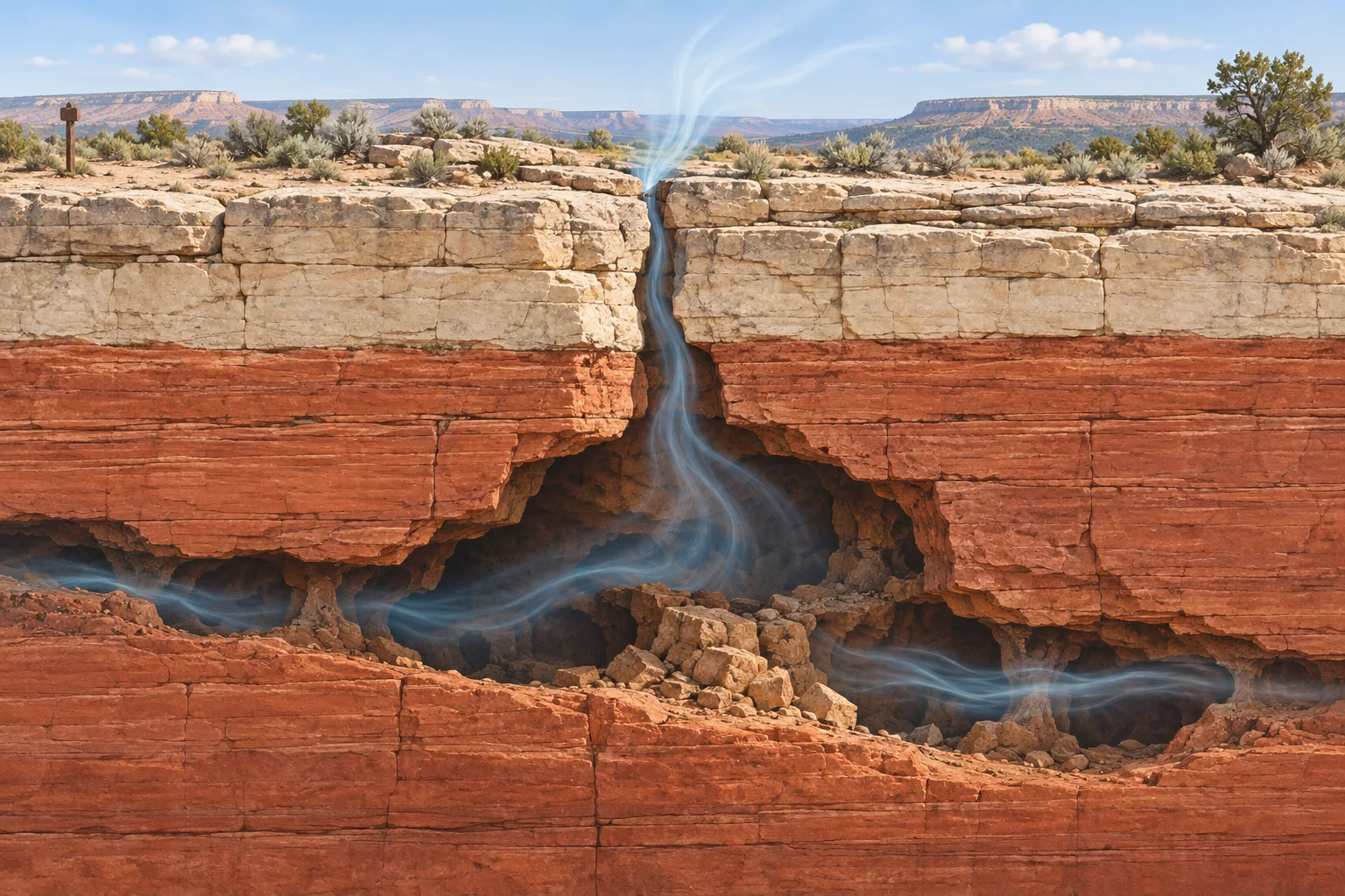
NPS describes a near-vertical fault that cut through Kaibab Limestone and Moenkopi Sandstone tens of millions of years ago. Groundwater moving through the fault dissolved limestone and helped create a fracture system that extends for miles beneath part of the monument. Its narrow passages leave much of the underground shape beyond direct human mapping.
The park’s estimate of roughly 7 billion cubic feet comes from measurements of airflow. It provides a useful sense of scale for the unseen fracture system while reflecting the limits of direct mapping.
Editorial illustration: Air movement through a narrow surface opening and a larger underground fracture system.
Why the air changes direction
The blowholes respond to weather conditions. NPS explains that when outside air is cool and dense, air tends to move into the ground. When the outside air is warmer and less dense, air tends to move out. Atmospheric pressure also affects the exchange, according to the park’s natural-resource material. The result can feel a little like a landscape inhaling and exhaling, even though it is ordinary physics acting through an extraordinary piece of geology.
That is why a visitor’s experience can differ from one hour or season to the next. The direction and strength of the airflow change with weather conditions, making the blowhole a vivid connection between the air above the desert and the air within the earthcrack system.
A place where geology and cultural landscape meet
The National Park Service describes the views of specific Ancestral Puebloan residents about the blowhole near Wupatki Pueblo as an open archaeological question. It also notes that Hopi stories describe such openings as a source of wind and the home of the wind god Yaponcha. These perspectives bring together a geological explanation for air movement and living cultural traditions connected to place.
Visitors can appreciate the strange effect from the trail. Wupatki asks people to stay on designated paths, respect the pueblo walls, and leave natural and cultural items in place. The most satisfying way to meet this oddity may be the simplest: stand on the trail, notice the air, and remember that the desert below your feet is more connected than it looks.
A deep note can roll across a dune in southern Colorado, as if a bass instrument had been buried beneath the sand. At Great Sand Dunes National Park and Preserve, the sound has a physical source: an avalanche of exceptionally dry sand moving down a steep slip face. The National Park Service records the phenomenon as “singing sands,” a rare natural sound that visitors can hear at only a small number of places worldwide.
Confirmed facts: sand can make a sustained tone
The park sits where wind, water, and sediment have spent millennia building a huge dune field against the Sangre de Cristo Mountains. The National Park Service describes the main active dune field as about 30 square miles, shaped by opposing winds and a continuing recycling of sand through the valley’s creeks and sand sheet.
During suitable dry conditions, a slide of sand down a steep face can set up a low, humming or booming tone. A 2007 field study led by researchers at Caltech measured sustained booming at several desert sites. Its principal tones fell between about 70 and 105 hertz, along with higher harmonics. That range helps explain the sound’s startling, musical character: it arrives as a steady low note with a clear dominant pitch.
Dryness matters. The study’s field observations linked sustained booming with an appropriate loose surface layer and steep, avalanching sand. The NPS sound library preserves a recording from Great Sand Dunes, offering a useful reminder that this story begins with a real acoustic event, heard in the open air.
Editorial illustration
How one leading explanation works
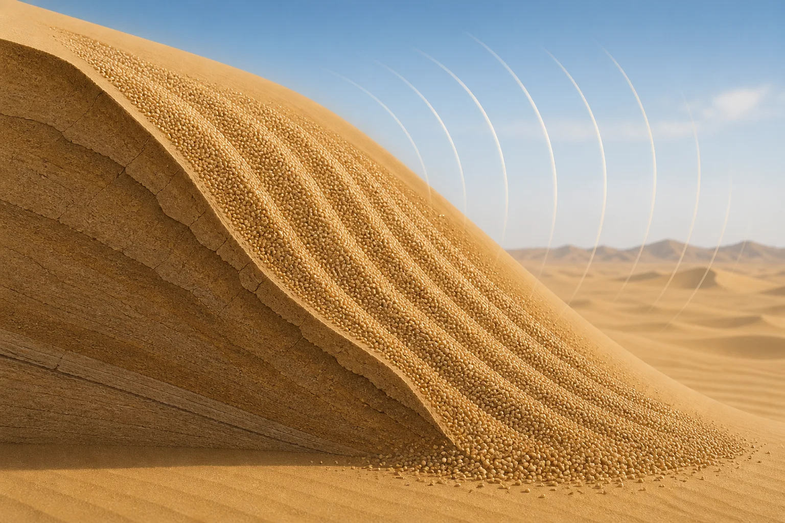
The Caltech team proposed a dune-scale waveguide. In their model, the moving avalanche supplies an acoustic pulse, while a shallow layer of dry, loose sand helps select and reinforce a particular frequency. Constructive interference in that layer can amplify the vibration, and the surface then couples the energy into the air as a powerful audible note.
That account connects several observed ingredients: a broad slip face, a surface avalanche, dry sand, and a tone that lasts longer than the visible surge of grains. It also gives the dune itself an active role. The feature acts as a landscape-sized resonator.
Folklore and familiar names
People have given sound-making sands vivid names for generations. A U.S. Geological Survey guide records “desert thunder,” “booming sands,” and “roaring sands” among the common labels. Explorers and travelers also carried tales of singing or droning dunes across deserts in Asia, Africa, and the Americas.
Those names belong to the human record of listening. They express awe and memory; laboratory evidence supplies a separate account of the mechanism. The word “singing” works as a graceful metaphor for a natural tone produced by moving sand.
What remains speculative
Researchers agree on the central observation: some dunes boom during suitable avalanches. The fine detail of frequency selection remains an active scientific question. A published response to the 2007 waveguide paper argued for a different account based on wave behavior in the surface layer and granular flow. The authors then replied with further support for their interpretation.
That exchange offers a healthy distinction. The sound, the avalanche, and the dry-sand setting stand on direct measurements. The exact route from grain motion to one dominant audible pitch carries competing models. Future field measurements can sharpen the picture.
A strange sound with a solid foundation
Great Sand Dunes earns its uncanny reputation through ordinary ingredients arranged in an extraordinary geometry: grains, gravity, dryness, slope, and a layered body of sand. The result feels theatrical, yet the surprise grows from physics unfolding at landscape scale. A dune can hold a note, and that simple fact makes a quiet desert feel briefly musical.
Across a flat dry lakebed in Death Valley, heavy stones leave long grooves in clay. Field observations, ice, shallow water, and a light wind supply the strange-but-true explanation.
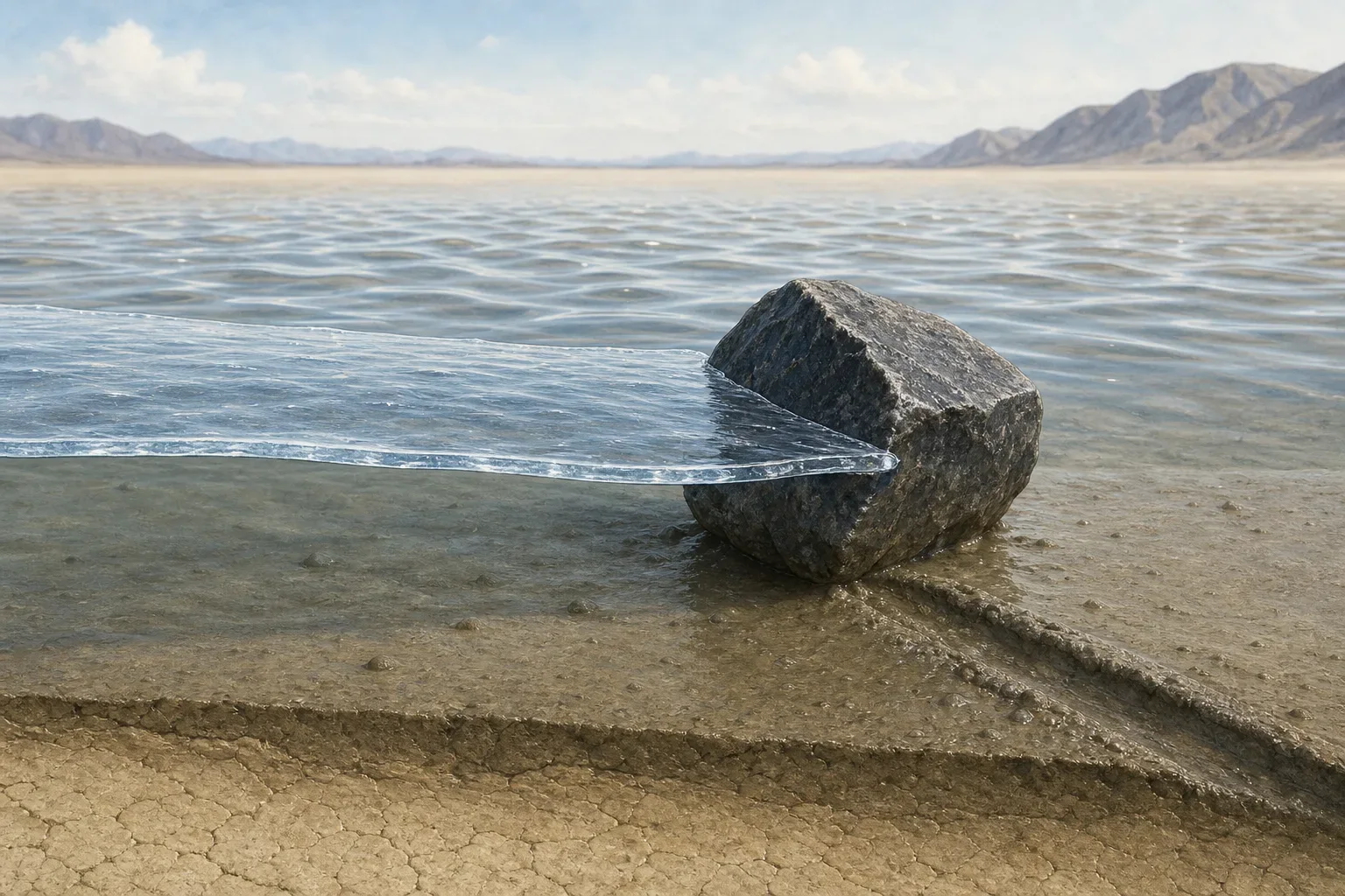
Editorial illustration of the conditions that can guide a stone across Racetrack Playa.
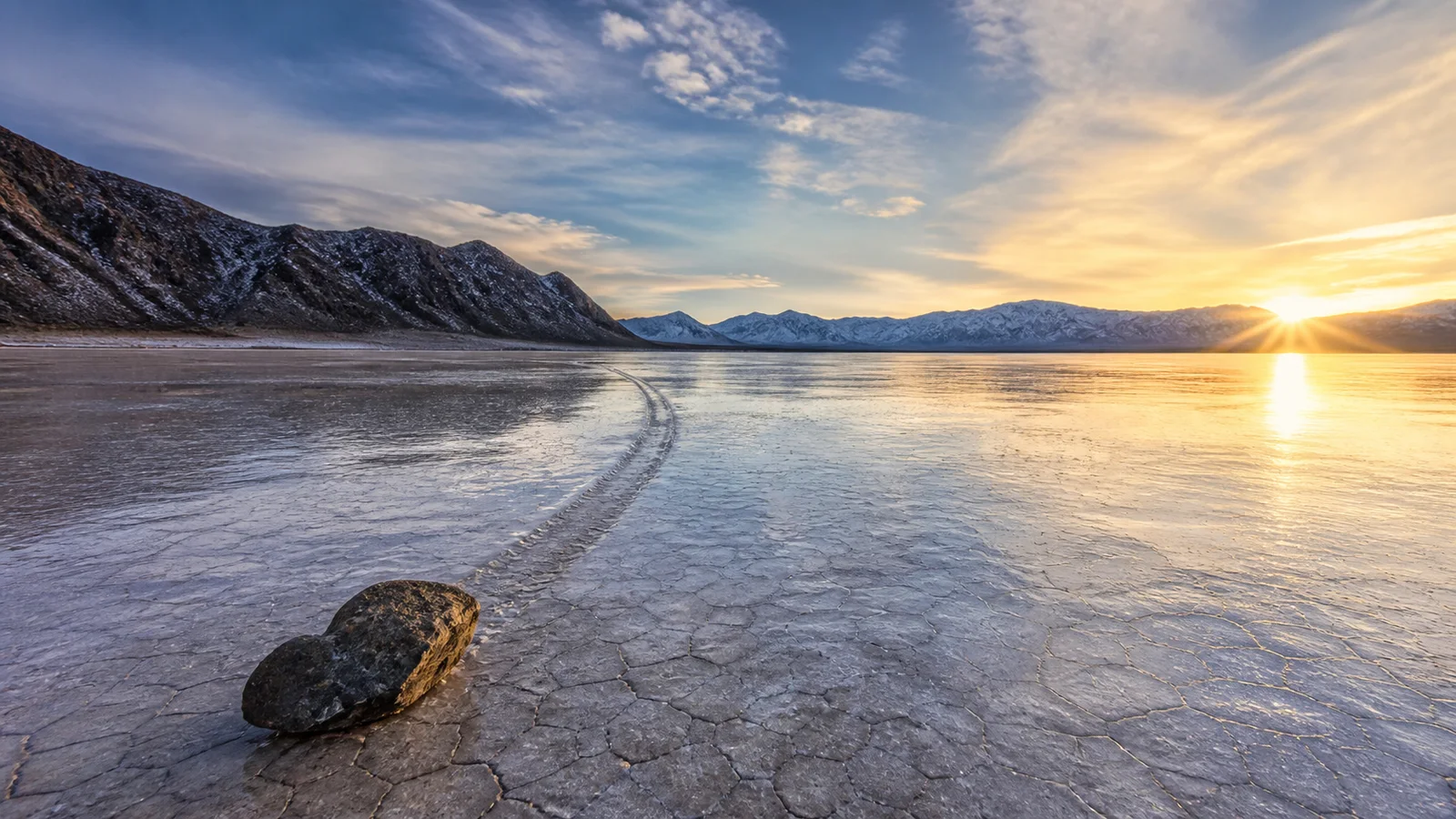
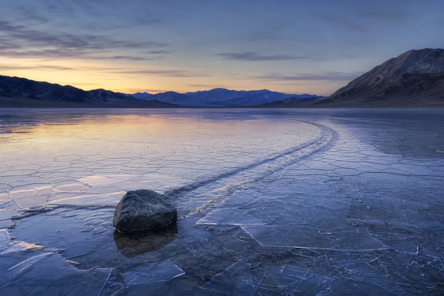
A rock trail on Racetrack Playa can look freshly drawn: one stone at its head, a narrow groove curling over pale clay behind it. The setting sits in Death Valley National Park, where the National Park Service describes a dry lakebed known for moving rocks. Some stones have traveled as far as 1,500 feet, according to the park’s visitor guide.
Confirmed facts: a stone can travel across the playa
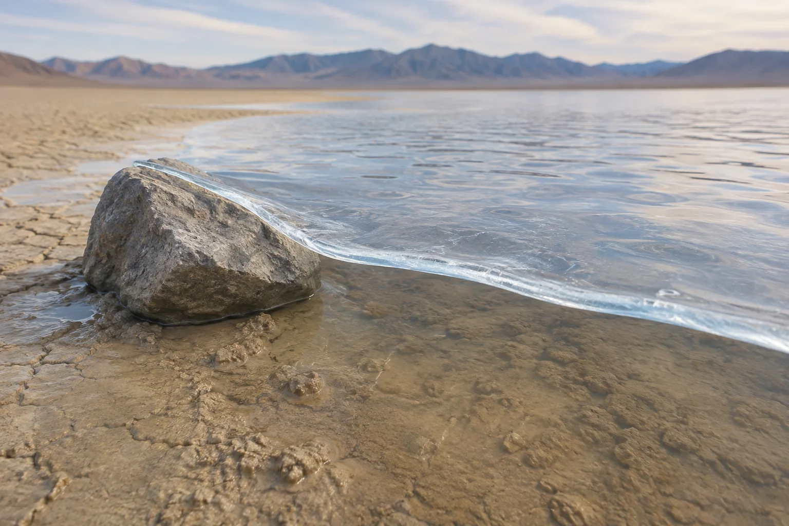
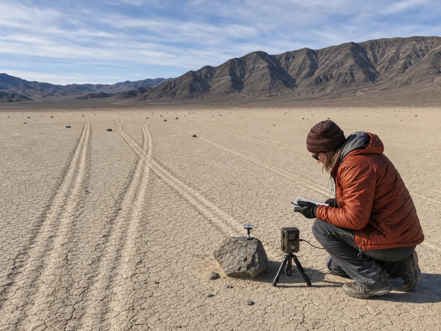
Researchers directly observed the movement during the winter of 2013–14. Their cameras, GPS-equipped stones, and weather station captured shallow water covering the playa, thin sheets of ice forming overnight, and sunlight breaking those sheets into floating panels. Light winds pushed panels across the water and the panels pressed stones through soft mud. A single observed event involved more than 60 moving rocks, and instrumented stones traveled as far as 224 meters across several events.
The pace remains wonderfully subtle. The research team measured speeds of roughly 2 to 5 meters per minute. From a distance, a visitor could easily see a quiet lakebed and a landscape full of tracks, while the actual motion unfolds during a short weather window.
Editorial illustration of a thin ice panel guiding a stone across wet clay.
Folklore and popular lore: a name built for a mystery
“Sailing stones” gives the landscape a story-sized name. The phrase belongs to popular desert lore: stones appear to travel under their own power, then pause beside a signature trail. Earlier scientific discussion also gathered several possible mechanisms, including powerful wind, liquid water, ice, and ice flotation. Those ideas form the history of the mystery, while the 2013–14 field record supplies a measured account of one sequence.
Speculation: each trail carries its own weather story
The direct observation explains a powerful route for motion, yet every trail reflects local conditions at a particular moment. Wind direction, water depth, ice-panel shape, stone size, and the clay surface can shape a path. The research paper describes trajectories guided by wind and flowing water beneath the ice. That leaves room for careful study of how individual trails gain their curves, parallel lines, turns, and varied widths.
Why the evidence matters
Racetrack Playa offers a useful lesson in wonder. The tracks were always real physical records. Patient observation turned a dramatic sight into a sequence of ordinary materials acting together: rain or snowmelt, freezing air, thin ice, sunlight, breeze, stone, and mud. The result still feels theatrical because the stage is so vast and the action is so quiet.
The park asks visitors to protect that stage. Stay on established roads, keep vehicles off the playa, and treat the fragile surface with care. A trail can preserve a rare weather event; a fresh footprint or tire mark can reshape the view for years.
Some desert dunes do something that sounds impossible until you hear the recording: they boom. At certain places, when a sheet of dry sand slides down a steep slope, the dune can produce a deep, sustained note—more like a distant aircraft or a giant bass speaker than a pile of loose grains.
The sound is documented at a small number of dune fields. The National Park Service lists Kelso Dunes in California’s Mojave National Preserve among them, and says only seven known sand-dune fields in North America produce the booming effect. At Great Sand Dunes National Park and Preserve in Colorado, the agency invites visitors to listen for “singing sands,” a natural sound made during an avalanche of sand.
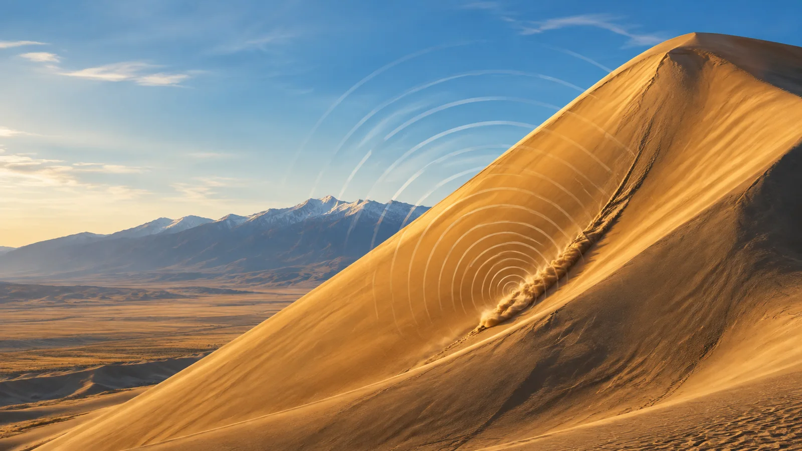
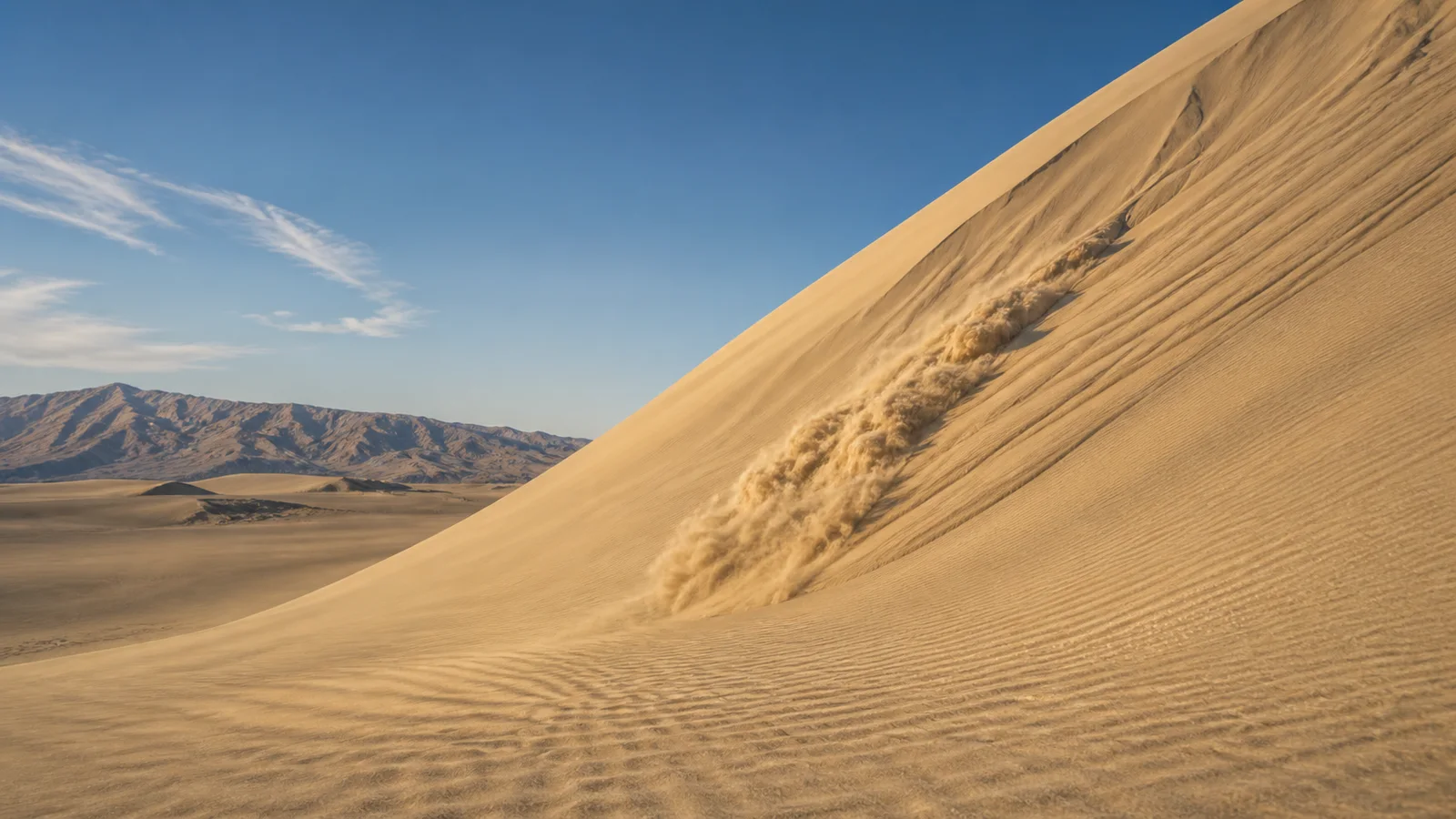
Editorial illustration: a sand avalanche moving down a steep dune slip face.
The concert begins with an avalanche
A booming dune is not singing because wind is blowing across its crest like air across a bottle. The trigger is a granular avalanche: a layer of sand loses its footing and flows down the dune’s steep “slip face.” The National Park Service describes the sound at Great Sand Dunes as a deep hum produced as air is pushed through millions of tumbling grains.
That description helps explain why the effect is so selective. A dune needs a particular combination of material and conditions. Research on singing sand has found that the grains are typically dry and fairly well sorted, so a large population of similarly sized grains can move together. Dampness, mixed grain sizes, or an avalanche that is too small or too disorganized can leave the slope silent.
The result can be surprisingly low. A field study of booming dunes reported a dominant audible frequency in roughly the 70-to-105-hertz range, accompanied by higher harmonics. That is bass territory: low enough to feel as a vibration in the body as well as hear as a tone.
Editorial illustration: the moving layer where sand grains flow and interact.
What the experiments actually show
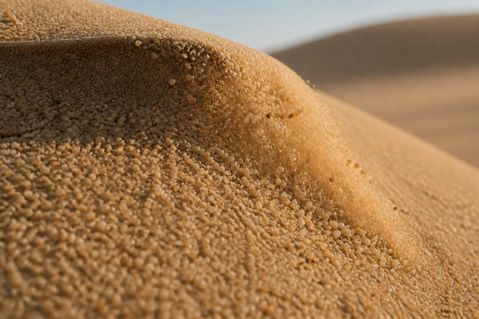
One influential 2006 study compared several booming dunes with controlled avalanches in the laboratory and field. Its authors concluded that the sound’s frequency matches the relative motion of the grains, and that the moving grains can synchronize their motion. In that picture, millions of tiny contacts cooperate long enough to produce one audible note instead of a heap of unrelated clicks.
That does not mean every sand grain is acting like a miniature tuning fork. The important behavior is collective. As grains slide, collide, and shear past one another, their movement can lock into a repeating pattern. The avalanche becomes a self-organized source of vibration, with the surrounding air carrying that vibration to a listener.
But “the grains synchronize” is not the end of the story. A 2012 study in Geophysical Research Letters tested singing-dune sand in laboratory avalanches over a hard plate. The researchers found that the sand could sing without a dune underneath it—and therefore without the dune’s internal layers acting as a required resonator. They also found that well-sorted grains produced a clearer frequency than polydisperse sand.
Editorial illustration: the rounded, closely packed grains that make a flowing sand layer audible.
A real phenomenon with an unfinished explanation
Another field study reached a different emphasis. It proposed that a thin layer of dry, loose sand near the surface can act as a natural waveguide, helping set the booming frequency as vibrations reflect through the dune. This does not erase the evidence for grain-scale synchronization; it highlights a different part of the system that may shape the sound people hear.
The careful conclusion is therefore narrower—and more interesting—than “scientists solved the singing dune.” Researchers agree on the observable sequence: suitable dry grains, a flowing avalanche, and a loud, sustained sound with a recognizable frequency. They continue to debate exactly how the moving grains, the shallow surface layer, and the surrounding dune couple together to produce and amplify that note.
That uncertainty is not a weakness in the evidence. It is a reminder that a familiar material can behave like a complicated instrument when enough of it moves together. The dune does not contain a hidden organ, and it is not making music in the human sense. It is a landscape-scale granular flow that briefly finds a rhythm.
Listen carefully, leave the sand where it is
The National Park Service describes booming or singing sand as a natural sound worth listening for, and warns visitors to respect the dune environment. Dune fields are protected landscapes with fragile surfaces and specialized plants and insects. The safest way to experience the phenomenon is to follow the preserve’s current guidance, avoid dangerous slopes and hot conditions, and treat the sound as a rare event rather than a performance that must be forced.
When the conditions line up, the desert can seem to have found a single enormous note. The strange part is not that sand can move. It is that grains with no instrument, strings, or voice box can move together closely enough for the whole slope to hum.
Sources
National Park Service, “Kelso Dunes” — identifies Kelso as one of the known North American booming dune fields and describes the low-frequency rumble.
At Racetrack Playa, visitors find stones at the ends of long trails. The trick behind the “sailing stones” is real, rare, and wonderfully ordinary: a little water, a little ice, and a little wind.
Editorial illustration: a sailing stone and its trail on the broad Racetrack Playa.
Imagine arriving at a dry lakebed and discovering that a rock has apparently gone for a stroll. There are no footprints around it, no tire tracks, and no helpful witness pointing toward the culprit. Only a long groove in the mud, sometimes bending gently across the pale floor.
That is the signature oddity of Racetrack Playa, a nearly level dry lake in a remote part of California’s Death Valley National Park. Stones scattered across the playa leave tracks that can run for hundreds of meters. The National Park Service says some rocks have traveled as far as 1,500 feet, while the stones themselves can weigh hundreds of pounds.
The fact: the rocks really move
For decades, the movement was inferred from the trails rather than watched. The playa is so remote, and the right weather so infrequent, that a person could spend a long time waiting for a performance that lasts only minutes.
That changed during a field project in the winter of 2013–14. Researchers Richard and James Norris, Ralph Lorenz, Jib Ray, and Brian Jackson placed GPS units on selected stones, set up time-lapse cameras, and monitored the weather. Their open-access study reports a largest observed event involving more than 60 rocks. Some instrumented rocks moved as far as 224 meters over several events.
The movement was slow enough to be easy to miss at a distance: roughly 2–5 meters per minute in the observed events. The rocks did not leap, roll dramatically, or glide through a supernatural force field. They were pushed along the wet surface by broad panels of floating ice.
Editorial illustration: a thin ice panel nudges a stone across shallow playa water.
The mechanism: a desert’s tiny winter pond
Racetrack Playa is usually dry, but winter rain or snow can briefly create a shallow pond. When night temperatures fall, the water can freeze into a sheet only a few millimeters thick. The study describes this as “windowpane” ice: thin, broad, and strong enough to form panels when it breaks up.
As sunlight warms the pond, the ice fractures. Light winds then move the floating panels across the water. When a panel meets a stone, it can push that stone over the soft, slick mud below. The water reduces friction; the ice supplies a broad surface for the wind to push. A track remains when the pond drains and the mud dries.
This explains why neighboring rocks can draw parallel lines and why some stones move while others stay put. Position, shape, water depth, ice breakup, and wind direction all matter. The researchers observed panels tens of meters wide moving rocks in winds of only about 4–5 meters per second—far gentler than the hurricane-force gusts once proposed.
The folklore: curses, aliens, and invisible helpers
Before anyone caught the process on camera, the trails invited stories. People proposed powerful winds, thick ice, slippery algae, seismic vibrations, and other explanations. Modern visitors sometimes add extraterrestrials or a desert curse to the list. Those are folklore and speculation: engaging ways to narrate a mystery, but not evidence for what moves the stones.
The more satisfying story is the documented one. A remote place made observation difficult; patient researchers brought instruments; and a rare combination of winter conditions finally supplied the missing scene. Mystery did not vanish so much as change shape. The question became less “Who dragged the rock?” and more “How often does this exact little weather machine switch on?”
Editorial illustration: field observation of parallel trails and a GPS-instrumented stone.
A phenomenon worth leaving alone
The National Park Service warns that the Racetrack is remote, roads can be rough, and there is no cell service. More importantly, the playa surface is fragile. Driving across it or walking on wet mud can leave scars that last for years, and the rocks are protected natural resources. The best way to meet a sailing stone is to let its trail do the talking.
So, if you ever stand at the edge of this enormous, quiet floor and see a stone at the end of a fresh-looking groove, you can enjoy both halves of the experience. The track is genuinely strange. The explanation is genuinely true. And somewhere under the right winter sky, a paper-thin sheet of ice may be preparing to give another rock a very slow ride.
Some desert dunes can answer an avalanche with a low, sustained boom. It is a real acoustic phenomenon, not a campfire story: at the right dune, a small slide of very dry sand can produce a deep tone that people describe as a hum, a drone, or a distant aircraft.
The National Park Service records “singing sands” at Colorado’s Great Sand Dunes National Park & Preserve and says the park is among the relatively few places where the deep humming or booming sound can be heard. California’s Eureka Dunes offer another carefully described example. There, the Park Service says the sound can accompany sand avalanching down the steepest face of the highest dune, and compares it with a pipe-organ bass note or a distant airplane.
Editorial illustration: a dry-sand avalanche on a steep dune face, the condition associated with a booming event.
Not every dune—and not every day
“Singing” is a useful name, but it can make the process sound more mystical than it is. The sound happens during a moving sheet of sand, especially when sand avalanches down a dune’s steep slip face. It is also fussy about conditions. The Eureka Dunes page says the sand must be completely dry; if the dune is damp, it may stay silent even when the moisture is not obvious to a hand on the surface.
That selectiveness helps explain why a broad dune field is not automatically a concert hall. Researchers distinguish booming dunes from more familiar squeaking or crunching beach sands. A review in Annual Review of Earth and Planetary Sciences describes booming as a phenomenon found at dozens of sites worldwide, with a dominant audible frequency commonly reported around 70 to 110 hertz plus higher harmonics. The particular note can persist longer than an observer might expect from a brief sand slide.
What scientists can say with confidence
A 2004 Physical Review Letters study reported that an avalanche excites elastic waves at a dune’s surface and that the motion of the grains can partly synchronize with those waves. A later review in Reports on Progress in Physics similarly describes the audible emission as a vibration of the sand excited by granular shear flow—the sliding and rearranging of grains in the moving layer.
Those findings give the phenomenon a solid physical footing: dry sand is moving, grains are interacting, and the dune is vibrating in a way that couples to the air as sound. They do not turn every detail into a closed case. The 2012 review evaluates several proposed mechanisms and says that some explanations have been rejected while amplification by guided elastic waves through friction still needed confirmation. In other words, the desert’s low note is documented; the most complete account of how a dune selects and sustains that note remains an active scientific question.
Editorial illustration: a conceptual cutaway of granular flow and subsurface vibration. It is an explanatory visual, not a measured map of a particular dune.
Why the caution matters
The audible result is so strange that it is easy to overstate it. Dunes are not producing a tune on command, and a visitor should not treat a fragile dune as an instrument to be tested. The Park Service’s descriptions are better read as an invitation to notice a rare natural process—and to follow site guidance that protects the dune and the habitat around it.
That restraint also makes the truth more interesting. A dune can look silent and still hold the ingredients for a sudden bass note: suitably dry grains, a steep moving layer, and a landscape capable of transmitting a collective vibration. The weird part is not that the desert is hiding a supernatural voice. It is that ordinary grains of sand can briefly behave like one remarkably large, resonant system.
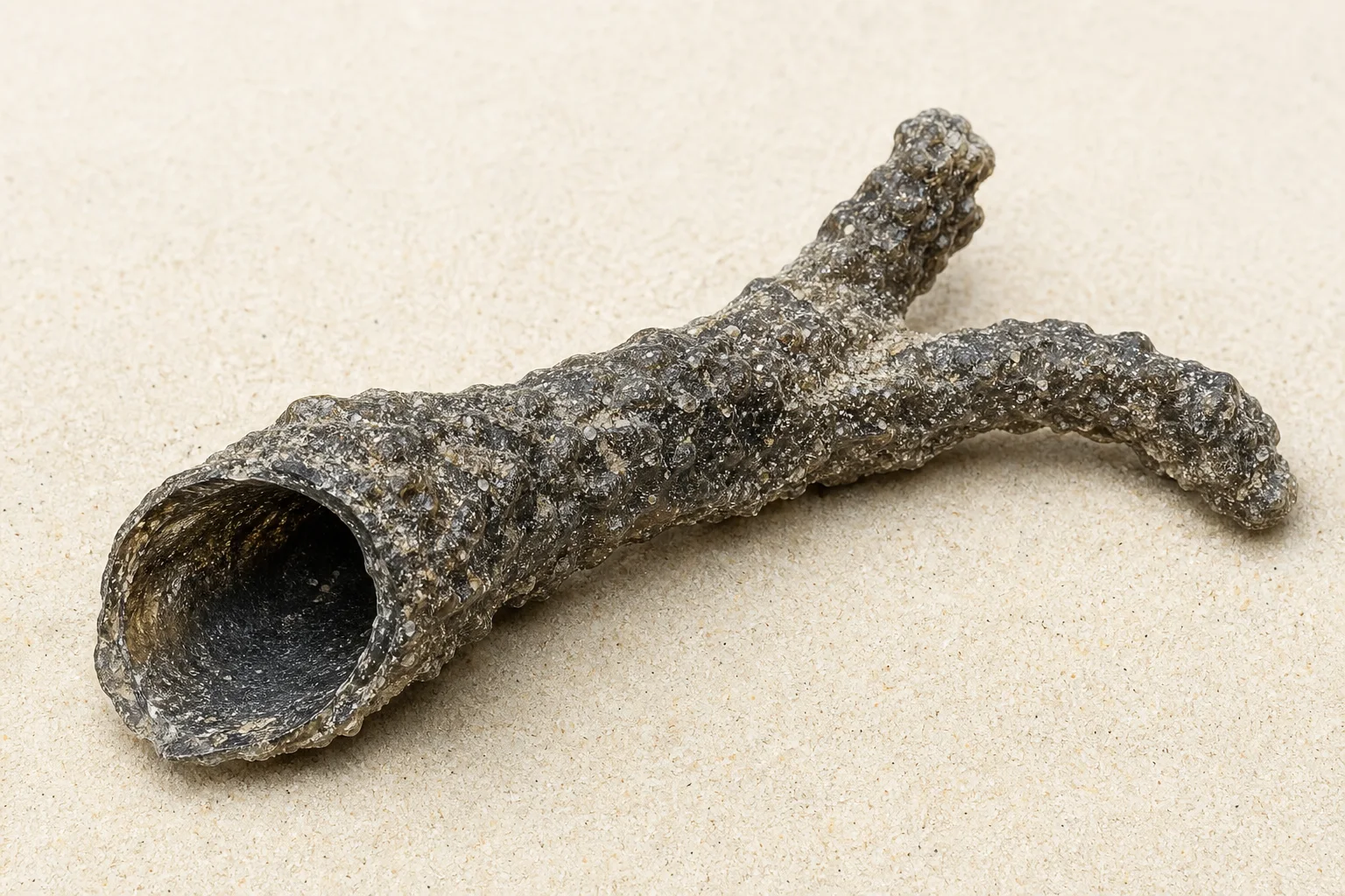
A thunderstorm can leave behind something that looks more like a root, a burnt twig, or an artifact from a fantasy film than a mineral. It is called a fulgurite: a fragile tube or branching mass of natural glass made when lightning strikes suitable ground.
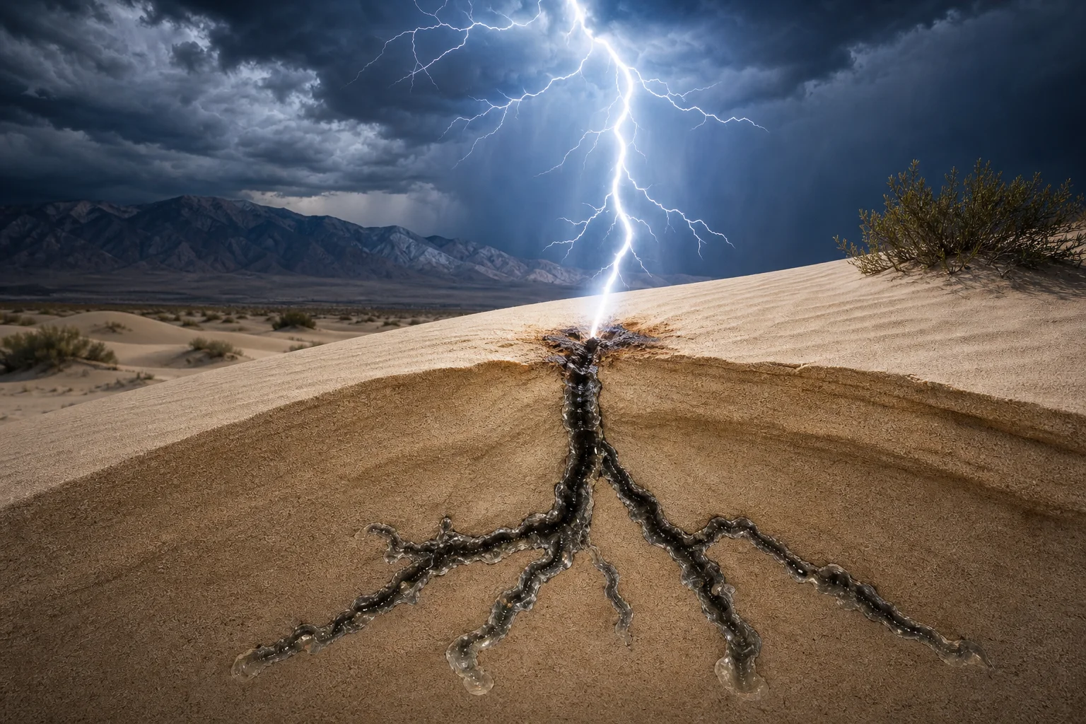
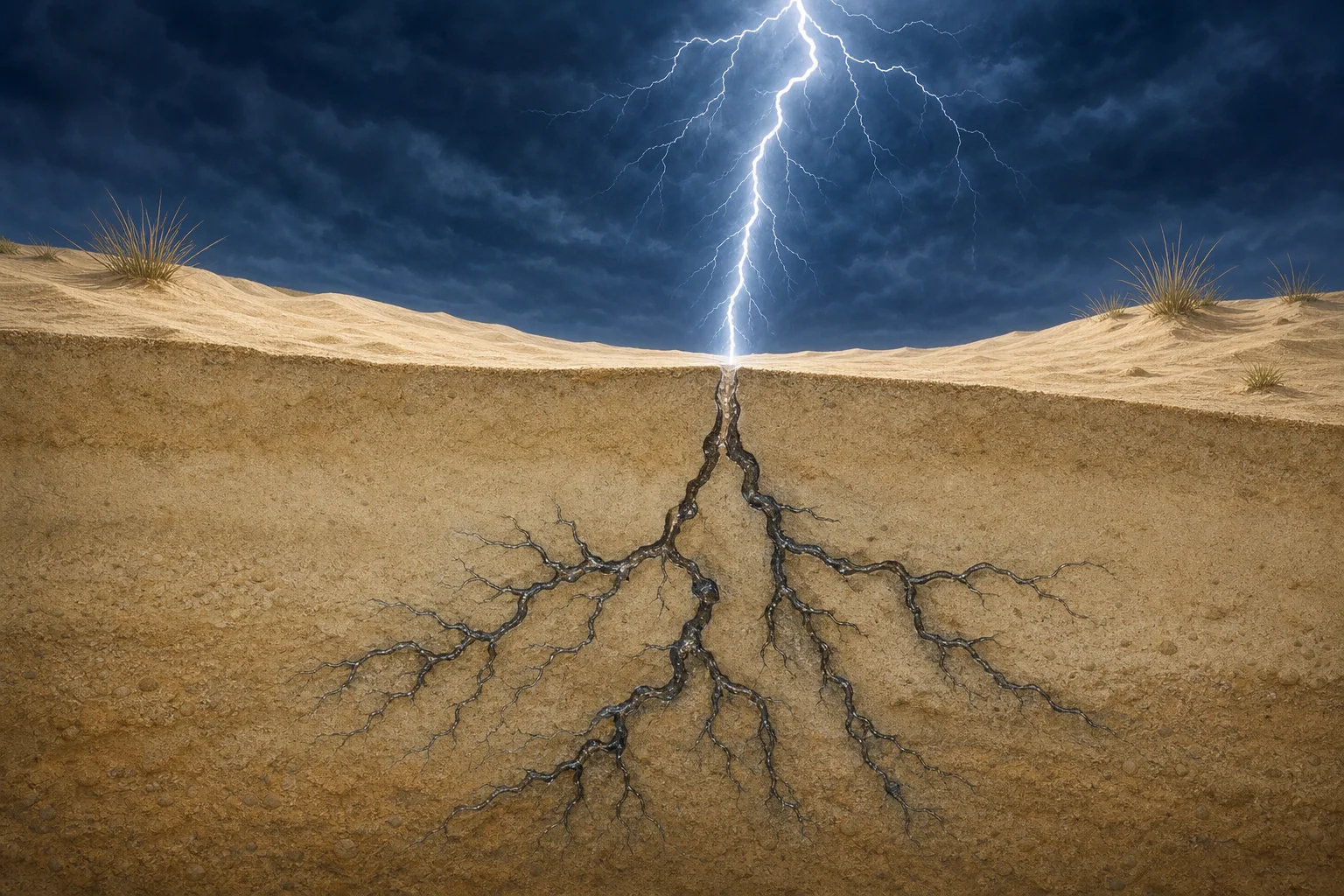
The usual version begins in sand. A bolt delivers an enormous burst of energy along a narrow path, melting the grains around it. As that material cools, it can preserve the bolt’s underground route as a dark, rough-walled tube. At Great Sand Dunes National Park and Preserve, the National Park Service describes fulgurites as blackish glass tubes formed when lightning strikes the dunes.
A lightning strike, preserved below the surface
Fulgurites are often found after erosion exposes them, which helps explain their odd silhouette. The central channel may be hollow, while the outside can retain grains of sand fused into a craggy skin. Some specimens branch. That is a visual echo of the way electrical paths can split through the ground, not evidence that the material grew there over time.
Editorial illustration
Sand is not the only starting material. The Smithsonian National Museum of Natural History maintains a fulgurite collection that includes both rock and sand specimens struck by lightning. Its collections overview also distinguishes pseudofulgurites: glassy material made by other intense heat sources, including burning coal seams and downed power lines. In other words, a dramatic-looking glassy tube needs context before it can be confidently identified as a lightning relic.
Why they do not look like ordinary glass
Window glass is manufactured from a carefully controlled melt. A fulgurite is the opposite: an instant, uneven melt of whatever mineral mixture was already present in one small patch of ground. That is why color, thickness, texture, and branching can vary so much from one specimen to another. A specimen formed in quartz-rich sand can look different from one made where lightning fused solid rock.
Editorial illustration
They are also easy to break. What survives is only a fraction of a very fast event, then exposed to shifting sand, water, weather, and curious hands. That fragility is part of the appeal: a fulgurite is a physical trace of a moment that lasted only an instant.
Look, do not collect
The strange part of a fulgurite is not that lightning can melt material. It is that the result can remain recognizable after the storm is gone. But it is not a reason to chase thunderstorms or dig into dunes. The National Park Service warns visitors at Great Sand Dunes to come down from the dunes when storms approach, and says fulgurites there should be left in place because park resources are protected for future visitors.
So the best way to appreciate a fulgurite may be the least dramatic one: after the weather is safely past, learn how to recognize the phenomenon, enjoy documented examples, and leave protected finds where their story can continue.
A Minnesota waterfall looks as if it sends half a river into a hole in the rock. It does not. The best measurements say the water returns to the Brule River below the falls—just out of sight.
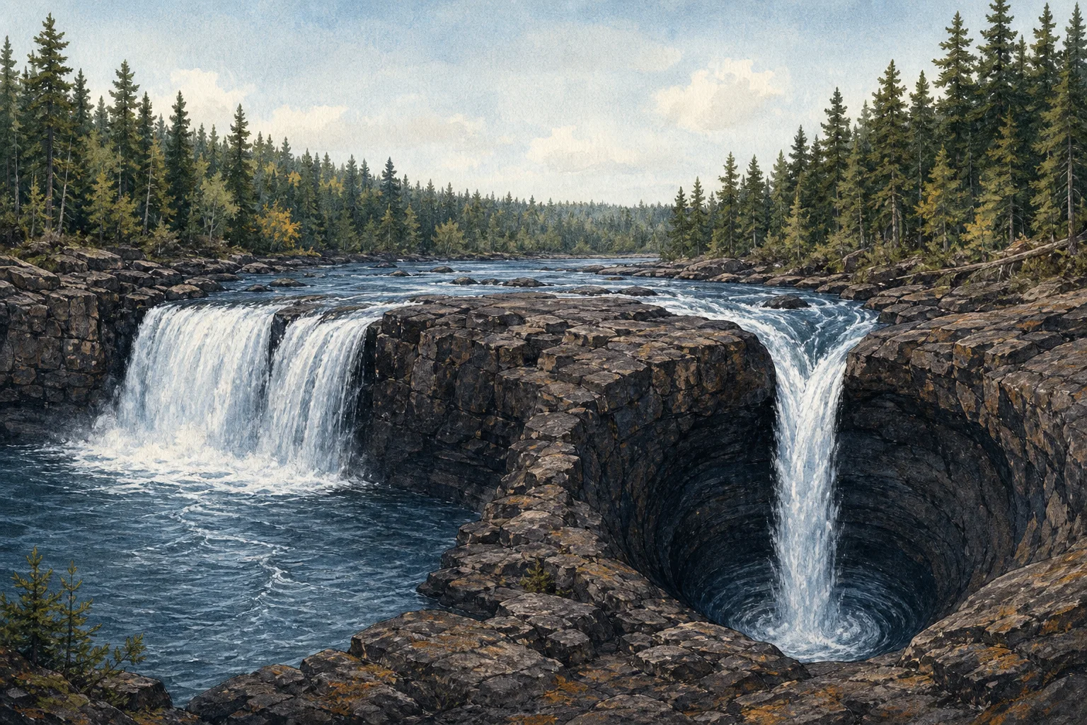
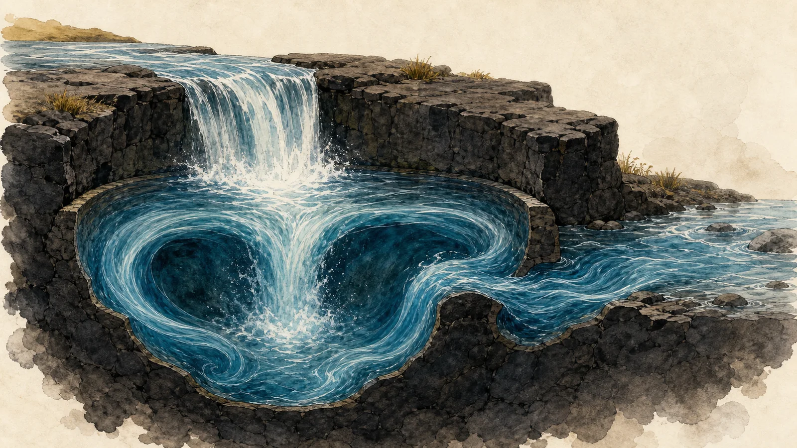
At Devil’s Kettle Falls in Judge C. R. Magney State Park, near Grand Marais, Minnesota, the Brule River arrives at a rocky ledge and splits. One branch makes an ordinary-looking drop into a pool. The other falls into a dark, rounded opening called the kettle. From the overlook, that second stream seems to vanish.
That visual trick has produced decades of perfectly reasonable questions: Is there a hidden tunnel? Does the water travel to Lake Superior? Why do tossed objects not immediately appear downstream? The short answer is less supernatural and more interesting: measuring the river turned out to be more useful than watching the hole.
What makes the falls look impossible
The Minnesota Department of Natural Resources describes the falls as a split in the Brule River, with one side dropping into a pool and the other into the large pothole. The park sits in a landscape shaped by ancient volcanic activity; the exposed rock around the falls is part of a thick volcanic flow complex. The setting matters because the popular “secret cave to Lake Superior” explanation would require a kind of long, open underground route that geologists did not expect in that hard volcanic rock.
Folklore naturally filled the gap. Visitors tried informal tests with sticks and other floating objects, then waited for a reappearance that did not come. Those observations are memorable, but they are not a water-budget experiment. A powerful plunge pool can trap, sink, break up, or delay visible debris, while the water itself keeps moving.
The clue was the flow above and below
In 2016, DNR hydrologists measured the river above Devil’s Kettle and then again several hundred feet downstream. They recorded 123 cubic feet of water per second above the falls and 121 cubic feet per second below. The DNR said the small difference was within the measuring equipment’s normal tolerance—effectively no missing water in the reach below the kettle.
That does not mean anyone can point to a neat pipe with a labeled exit. It means the simplest explanation fits the observations: the water entering the kettle resurges into the Brule River downstream, where a turbulent, submerged system hides the route from a visitor at the overlook. The DNR reported that a dye trace was planned as a later visual test; the stream-gauging result itself is the evidence behind the conclusion that the river is not being diverted away.
Editorial illustration generated for Weird News. It is a conceptual visualization of turbulent water, not a documentary image or a map of the falls.
Why a missing stick is not a missing river
Water and floating objects do not behave alike in a violent plunge pool. The DNR’s 2017 account quoted University of Minnesota geologist Calvin Alexander’s explanation that the pool’s recirculating currents can hold material underwater and break it apart before it resurfaces farther downstream. In other words, a log is a poor tracer: it has size, buoyancy, drag, and a tendency to get caught in chaotic flow. A flow measurement, by contrast, compares the river’s total volume.
That distinction turns Devil’s Kettle into a useful lesson in how a good mystery gets investigated. The striking view raised a question; the geology narrowed the plausible answers; then hydrologists checked whether the river was actually losing water. The result leaves room for wonder at the hidden turbulence without needing to invent a tunnel.
A strange place, with a very ordinary accounting
Devil’s Kettle is still an odd thing to see: a river splitting around a rock rib, with one half visibly continuing and the other apparently swallowed. But the known evidence supports a less dramatic destination. The water is still part of the Brule River.
If you visit, keep the mystery observational. Follow current park guidance, stay on designated trails and overlooks, and do not throw objects into the water to repeat the old tests. The point is not to make the river reveal its route on command; it is to notice how much can happen in a few hidden, turbulent seconds.
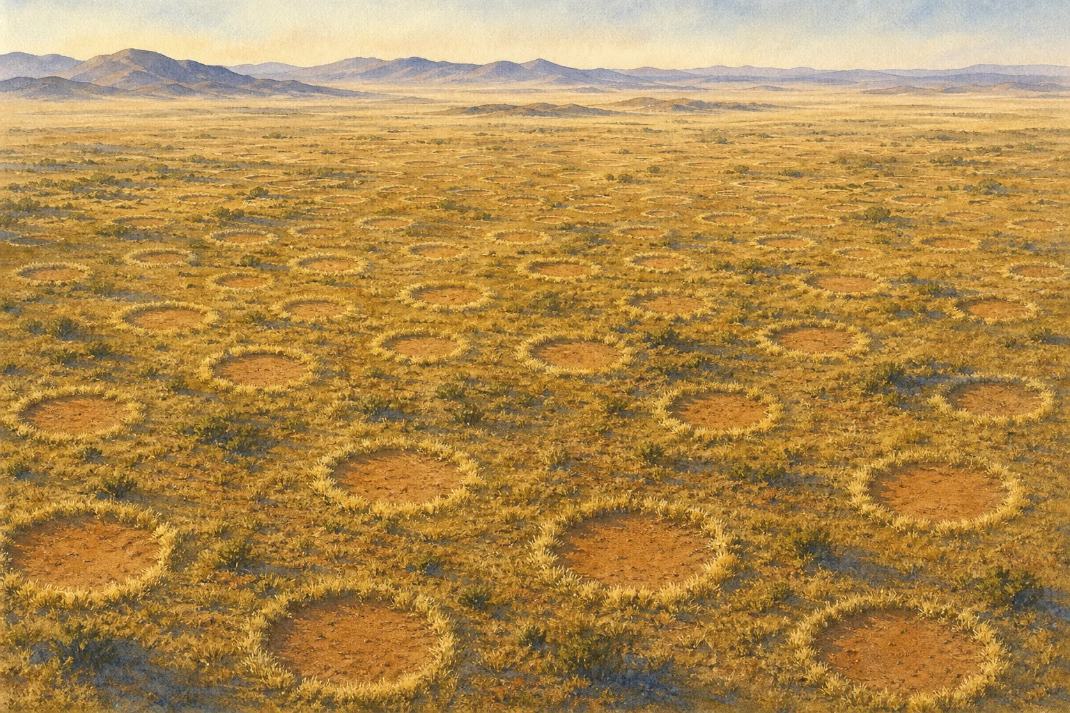
Across the dry grasslands along the eastern edge of the Namib Desert, bare circles repeat across the landscape with an order that looks almost designed. Many have a rim of taller grass. In dense fields, the gaps can settle into a roughly hexagonal spacing, as though the plants—or something beneath them—had agreed on personal boundaries.
They are called fairy circles, but the name is folklore, not an explanation. The circles are real natural features, and scientists have spent decades testing what makes them. The durable weirdness is that the leading explanations still point in different directions.
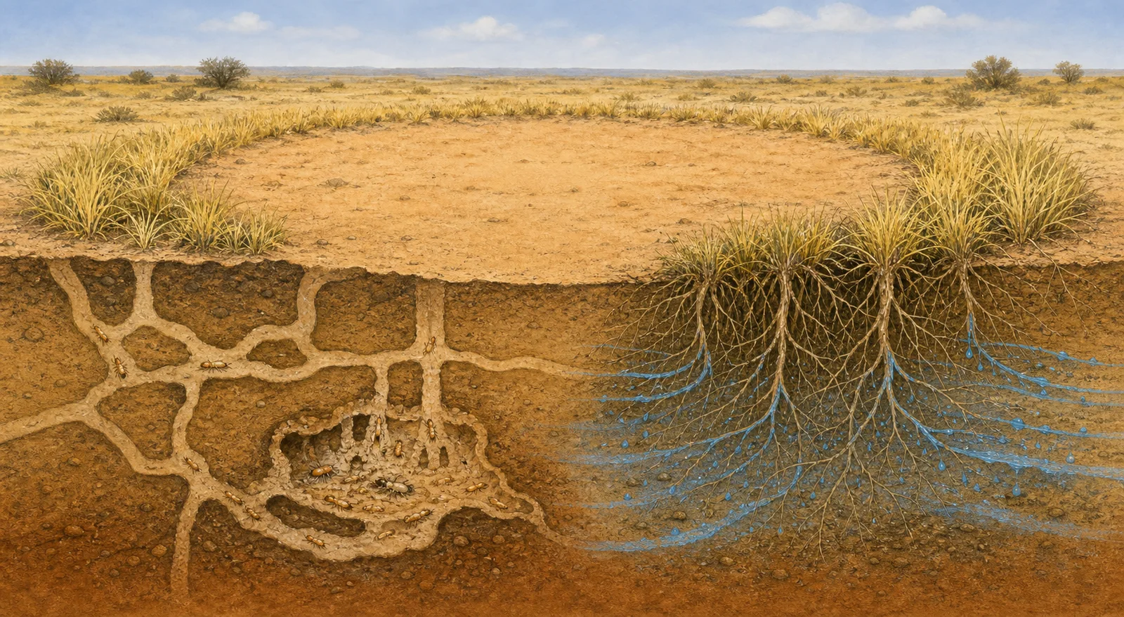
Two leading ideas involve sand termites and competition among grasses for scarce water. This is an original editorial illustration, not a field image or scientific reconstruction.
What is documented
The circles occur in arid, sandy grasslands in southern Africa. A 2013 field and remote-sensing study described millions of barren patches, commonly a few meters across, often surrounded by taller perennial grasses. The researchers also found that soil moisture inside a bare circle decreased toward its grassy edge. That pattern is consistent with roots around the perimeter drawing on water stored beneath the center.
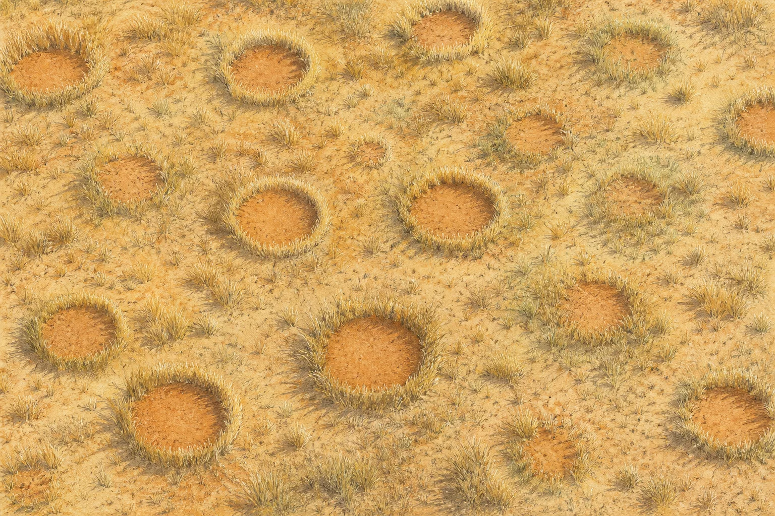
The circles are not simply dead stains. They can appear, persist and eventually fade as vegetation returns. Their repeated spacing is also nonrandom. Any successful explanation therefore has to account for several things at once: why plants disappear from the middle, why taller grass often grows around the rim, and why neighboring circles keep such regular distances.
Explanation one: termites as ecosystem engineers
In a Science paper published in 2013, ecologist Norbert Jürgens argued that the sand termite Psammotermes allocerus creates the circles by removing short-lived vegetation after rain. With fewer plants transpiring from the center, water can remain in the sandy soil. The stored moisture can then support the perennial grass ring and help a termite colony survive long droughts.
Under this interpretation, each bare patch is less a scar than a water-harvesting ecosystem engineered from below. Competition between neighboring termite colonies could also help explain the broad spacing between circles.
That is a scientific hypothesis backed by field observations, not a universally accepted verdict. Other researchers have questioned whether the presence of termites proves they initiate every circle, and whether termite activity alone explains the landscape-scale geometry.
Explanation two: thirsty grass organizes itself
A competing body of research treats the circles as an emergent pattern produced by plants competing for extremely limited water. In this view, grasses close to an established clump benefit from local conditions, while their roots pull water from farther away. The push and pull between short-range cooperation and longer-range competition can generate evenly spaced vegetation patterns without a planner.
The 2013 study by Michael Cramer and Nichole Barger found that circle occurrence and geometry tracked environmental conditions such as water availability and soil properties. A later field study, published in 2022, followed rainfall across Namib sites and reported that new grasses inside circles died from water stress without the root damage expected from termite feeding. Its authors concluded that plant water competition, rather than termite herbivory, caused the observed grass death at their study sites.
Circles can emerge, persist and fade as grassland conditions change. Original editorial illustration; not satellite imagery or scientific evidence.
A clue the circles are not one giant grass plant
Another possible explanation once proposed that the grass rim could be a single clone expanding outward while dying in the center, similar to some familiar rings of vegetation. Genetic testing published in Communications Biology in 2020 did not support that idea for the Namib circles it sampled. The grasses around almost every tested circle belonged to more than one genetically distinct individual.
That result removed one tidy answer. It also sharpened the real question: how do many separate organisms generate a pattern that lasts much longer than the individual grass plants marking its edge?
Could both mechanisms matter?
Termites and plant competition are not necessarily mutually exclusive at every scale. A 2017 modeling study in Nature found that interactions between vegetation feedbacks and territorial social-insect colonies could reproduce multiple features seen in patterned drylands. Its broader conclusion was that more than one self-organizing mechanism may operate together.
That does not mean “both” is the final answer for every Namibian circle. Different studies examine different sites, rainfall events, time spans and measurements. Evidence that explains freshly dying grass may not by itself explain decades of circle persistence; finding termites beneath a circle does not automatically prove they started it.
The honest answer is more interesting than a premature solution. Namibia’s fairy circles are documented ecology wearing a supernatural nickname. Scientists can measure their soil, map their spacing, identify their grasses and inspect the creatures below—yet the full chain of cause and effect remains under debate.
For decades, the tracks on Racetrack Playa looked like evidence of an impossible commute. Stones sat at the ends of long grooves in the mud, yet nobody had watched them travel. Some paths ran nearly parallel; others curved, crossed, or stopped while a nearby stone kept going. The desert offered plenty of suspects—violent wind, slippery algae, thick floating ice—but not a witnessed mechanism.
The first direct scientific observations arrived during the winter of 2013–2014. Researchers had installed a weather station, time-lapse cameras, and 15 specially prepared limestone rocks containing GPS loggers. Then a shallow pond formed on the playa, froze on cold nights, and began breaking apart under the late-morning sun.
The push came from ice—but not the ice people expected
The answer was surprisingly delicate. In a 2014 peer-reviewed study, Richard Norris and colleagues reported that sheets of “windowpane” ice only about 3 to 6 millimeters thick could push stones when three conditions lined up. The playa first needed enough water to create a shallow pond. A cold night had to freeze its surface. Then sunlight and light wind had to arrive together as the ice softened and fractured.
AI-generated explanatory illustration: thin floating ice, driven by light wind and moving water, can press against a stone on the slick playa surface. It is not observational evidence.
Large floating panels—tens of meters across despite being only millimeters thick—were driven across the pond by light winds and flowing water. When a panel met a rock that projected high enough above the water, the ice pressed against it and nudged it across the wet mud. The moving rock carved the trail that would become obvious after the water and ice disappeared.
This was not a dramatic sprint. The observed stones moved at roughly walking pace or slower, commonly a few meters per minute. One directly watched movement on January 9, 2014 lasted about 18 seconds at around 1 to 2 meters per minute. GPS-equipped stones recorded longer events. Two rocks that started about 153 meters apart began moving within six seconds of each other on December 4, 2013, traveling more than 64 meters in 16 minutes.
Why the mystery lasted so long
Racetrack Playa is remote, and the necessary weather is rare. The National Park Service says the moving-rock phenomenon requires a precise sequence of rain, freezing temperatures, sun, and wind. Years can pass without a suitable event. Even when the stones do move, their slow motion is difficult to notice casually, and their new trails may stay hidden beneath muddy water until the pond is blown or evaporated away.
The thinness of the ice also helped the process evade earlier explanations. Some hypotheses imagined rocks frozen into thick rafts that partly floated them off the lake bed. The observed mechanism did not lift the stones. Instead, broad but fragile ice panels supplied a gentle horizontal push while the wet clay reduced resistance.
That fragility explains why neighboring tracks are not always identical. A panel can split when it strikes a stone or a fixed obstacle, disconnecting rocks that had been moving together. Low stones can be overridden by the ice, while taller ones catch its edge. Water depth, rock profile, ice fractures, wind direction, and the flow beneath the ice all influence which stones move and where they go.
A solved mechanism, not a scheduled show
The science explains how the sailing stones can move; it does not make the event predictable for visitors. The National Park Service warns that the playa surface is extremely fragile. Driving on it is prohibited, and walking on it when muddy leaves scars that can last for years. The rocks themselves should never be moved.
What remains at Racetrack Playa is stranger than a supernatural story because it is so restrained: a temporary pond, a cold night, sunlight, a light breeze, and ice thin enough to look powerless. Given the right geometry and timing, those ordinary ingredients can reorganize stones across a desert floor—and leave the evidence long after the motion has stopped.