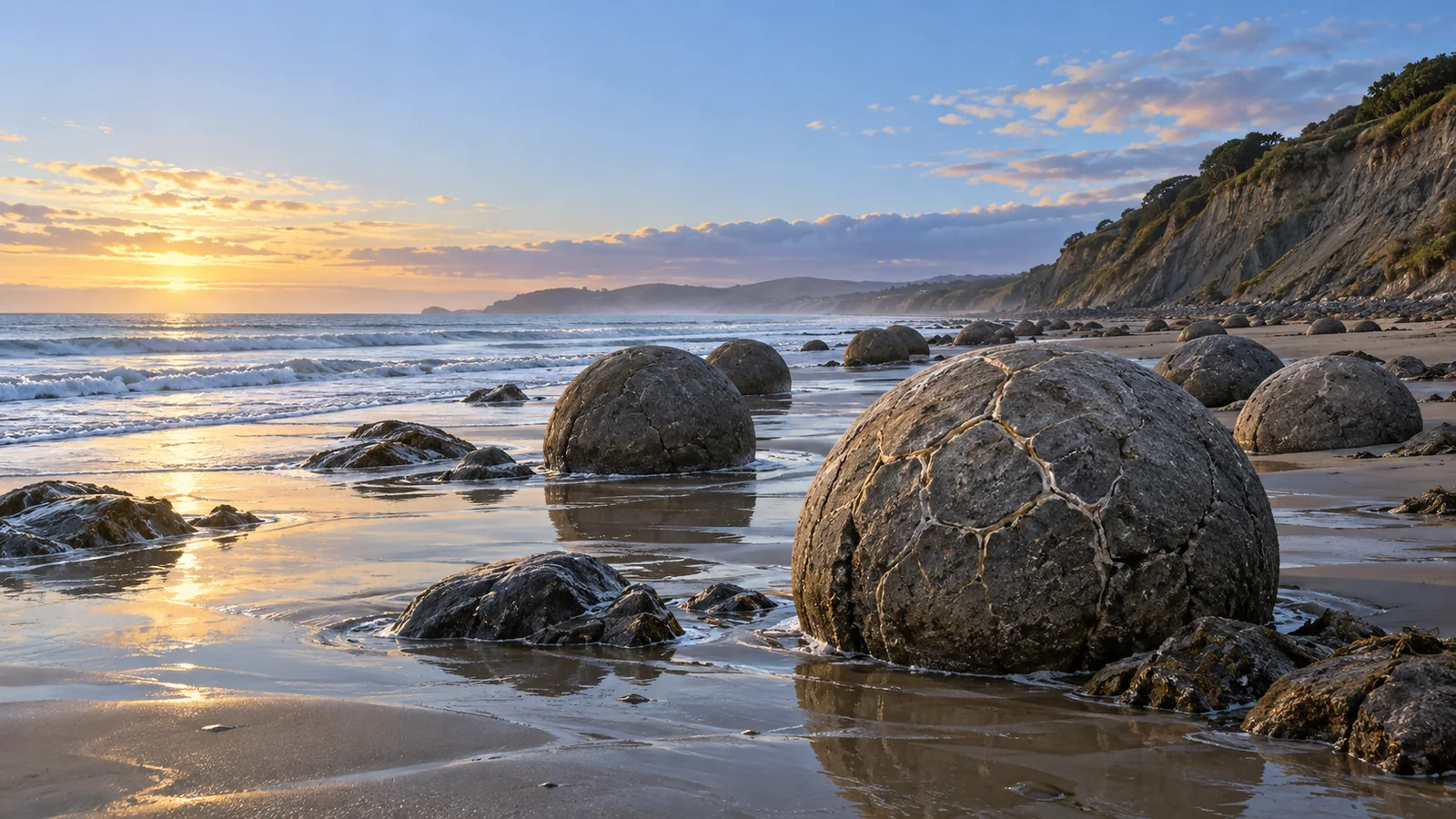
On a beach in Otago, Aotearoa New Zealand, the tide threads around boulders that look suspiciously like a giant misplaced bag of marbles. The Moeraki Boulders / Kaihinaki are real stone spheres, some large enough to make a person look small beside them. They grew inside ancient mudstone, then the coast gradually set them free.
The oddity is heightened by a second, equally important story. In Māori tradition, the round forms at this coast are connected with the wreck of the voyaging waka Ārai-te-uru. A good explainer keeps those accounts distinct: geology describes mineral processes; tradition records relationship, place, and memory. Both deserve to be named accurately.
Confirmed: these are giant mineral-grown concretions
The New Zealand Department of Conservation calls the Moeraki Boulders / Kaihinaki geological marvels exposed as surrounding mudstone erodes. The agency says the sedimentary rocks here were laid down roughly 65 to 13 million years ago and that the boulders formed through the gradual precipitation of calcite in mudstone over about four million years. A concretion is a compact mass of mineral-cemented sediment that grows within surrounding sedimentary rock; at Moeraki, the result is unusually large and strikingly spherical.
Geologist James R. Boles and colleagues described the boulders in a peer-reviewed study as calcite concretions reaching about two metres across, with internal septarian veins of calcite and smaller amounts of other minerals. Those pale seams are part of why a weathered boulder can look like an enormous stone turtle shell or a cracked hard-boiled egg. Geologists classify the structures as calcite concretions, while the resemblance supplies visual fun.
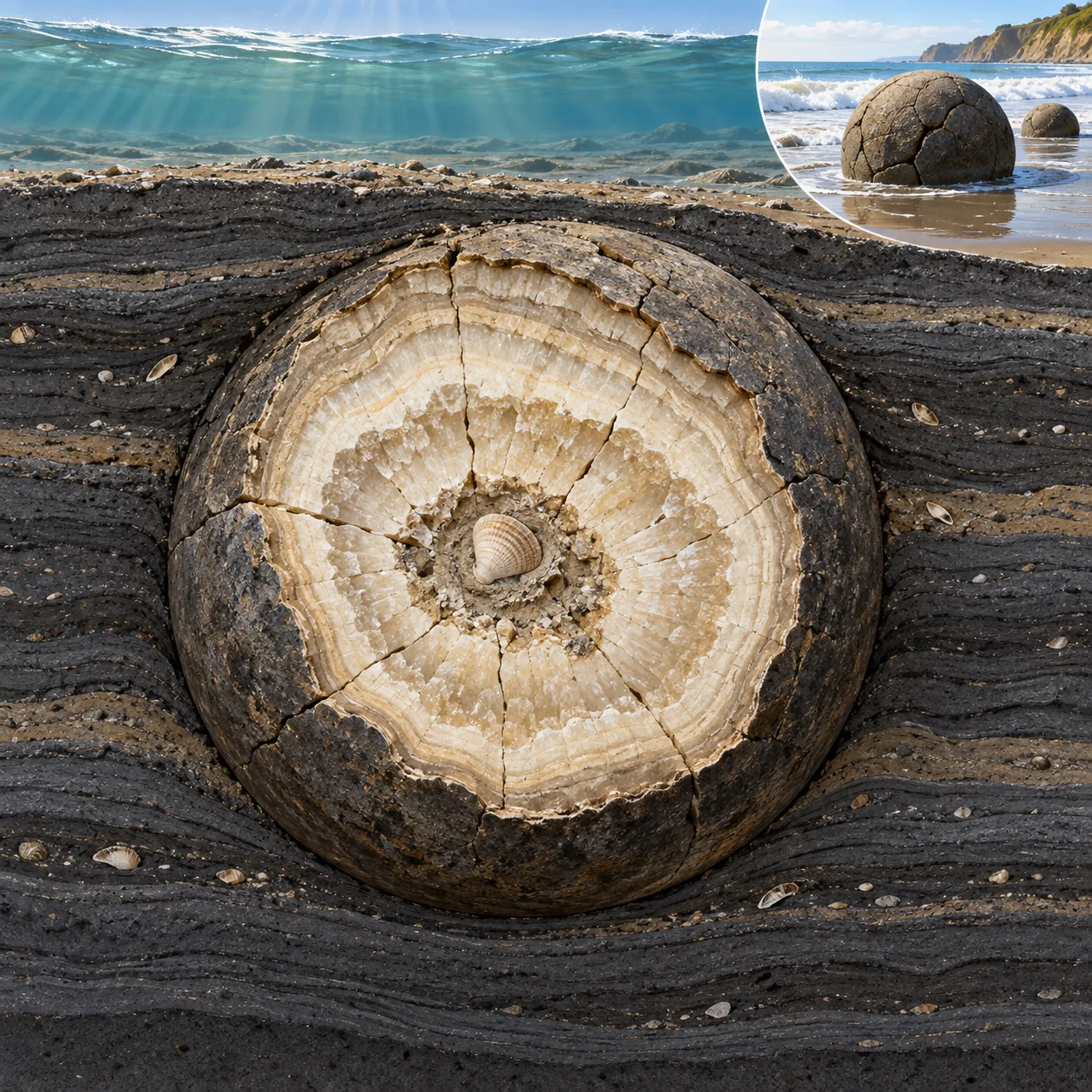
Here is the slow-motion version. Fine sediment accumulated on an ancient seafloor. In that mud, dissolved minerals precipitated and cemented sediment together around centres of growth. Over immense time, the hardening body expanded into a rounded concretion. Much later, coastal erosion wore away the softer enclosing mudstone. The resistant spheres emerged, while more can still be seen partly embedded in the cliff.
Confirmed: the coast is still doing the revealing
The boulders form a living coastal display revealed by erosion. The Department of Conservation notes that erosion exposes them from the surrounding mudstone; its management material describes boulders at the foot of the cliff as well as partly embedded forms above the tide line. The site feels less like a sculpture garden than a paused geological process. Every visible sphere is a chapter of rock history, and the cliff remains the next page.
That process also explains why individual boulders differ so much. Some remain almost whole; some have weathered into broken segments; others reveal their pale calcite vein network. The famous roundness is real, while each sphere carries its own natural variation. Nature has made durable spheres, then handed them to surf, salt, wind, and time.

Folklore and tradition: a waka, gourds, and eel baskets
Waitaki District planning material records a Kāi Tahu tradition connecting the boulders with the voyaging waka Ārai-te-uru. In that account, round food baskets and water-carrying gourds were lost overboard and formed the boulders before the waka continued south and capsized at Matakaea. The Department of Conservation uses the names Moeraki Boulders / Kaihinaki and Te Kaihinaki for the site.
This is a tradition alongside the mineral-formation account. Present it as cultural history, while the geological account describes the evidence from calcite and sediment. The accounts answer different questions: one explains how the stones formed; the other locates the remarkable coast within an inherited history of voyage, loss, food, and place.
What remains speculative
Scientists can study the boulders’ mineral chemistry and structure. Reconstructions of their earliest growth conditions draw on the rock record: the surrounding mudstone, the mineral cement, and the textures left inside each stone. A shell fragment, organic matter, or another small feature can serve as a possible growth focus for concretions in general; current evidence leaves the precise starting particle of any one Moeraki boulder open.
The evidence already offers a delightful mystery. Their verified explanation is slower and stranger: a coastal landscape has been opening mineral spheres that began growing in ancient seabed mud, one erosion season at a time.
Sources: New Zealand Department of Conservation, “Moeraki area”; New Zealand Department of Conservation, “Moeraki Boulders/Kaihinaki Walk”; Waitaki District Council: Outstanding Natural Features schedule; National Library of New Zealand: Boles, Landis and Dale, “The Moeraki Boulders — Anatomy of Some Septarian Concretions”.
Leave a Reply