All images in this article are Editorial illustration.s, created to explain the technology. They are not photographs of a particular surviving arrow or beacon.
In parts of the American West, a hiker or satellite-image browser can still run into an odd piece of aviation infrastructure: a giant concrete arrow, laid flat on the ground and pointing toward an empty horizon. It can look like a forgotten piece of roadside art. In fact, it was part of an early navigation system built for the age when getting lost after sunset could make air mail slower than the train.

Before electronic navigation, the ground had to give directions
Early air-mail pilots often navigated visually, following railroads, rivers and towns. Night flying made that method especially precarious. The National Air and Space Museum describes a 1921 cross-country test in which bonfires were meant to help pilots find the route; only one of the two mail planes completed the trip after an Omaha fire was left unlit. The episode helped make the case for a more reliable, built system of guidance.
That system became the lighted airway. The Smithsonian records the first lighted airway beacon in 1923, and the Federal Aviation Administration says the standardized installations were typically placed about 10 miles apart. A 51-foot tower carried a powerful rotating light, while two course lights pointed forward and backward along the route. The lights could flash a code identifying the beacon site.
Why the arrows were so enormous
The lights worked at night. By day, pilots needed a simpler cue: the tower usually stood in the center of a concrete arrow about 70 feet long, according to the FAA’s historical account. The arrow pointed toward the next beacon. Where a generator shed was needed, it sat at the feather end of the arrow.
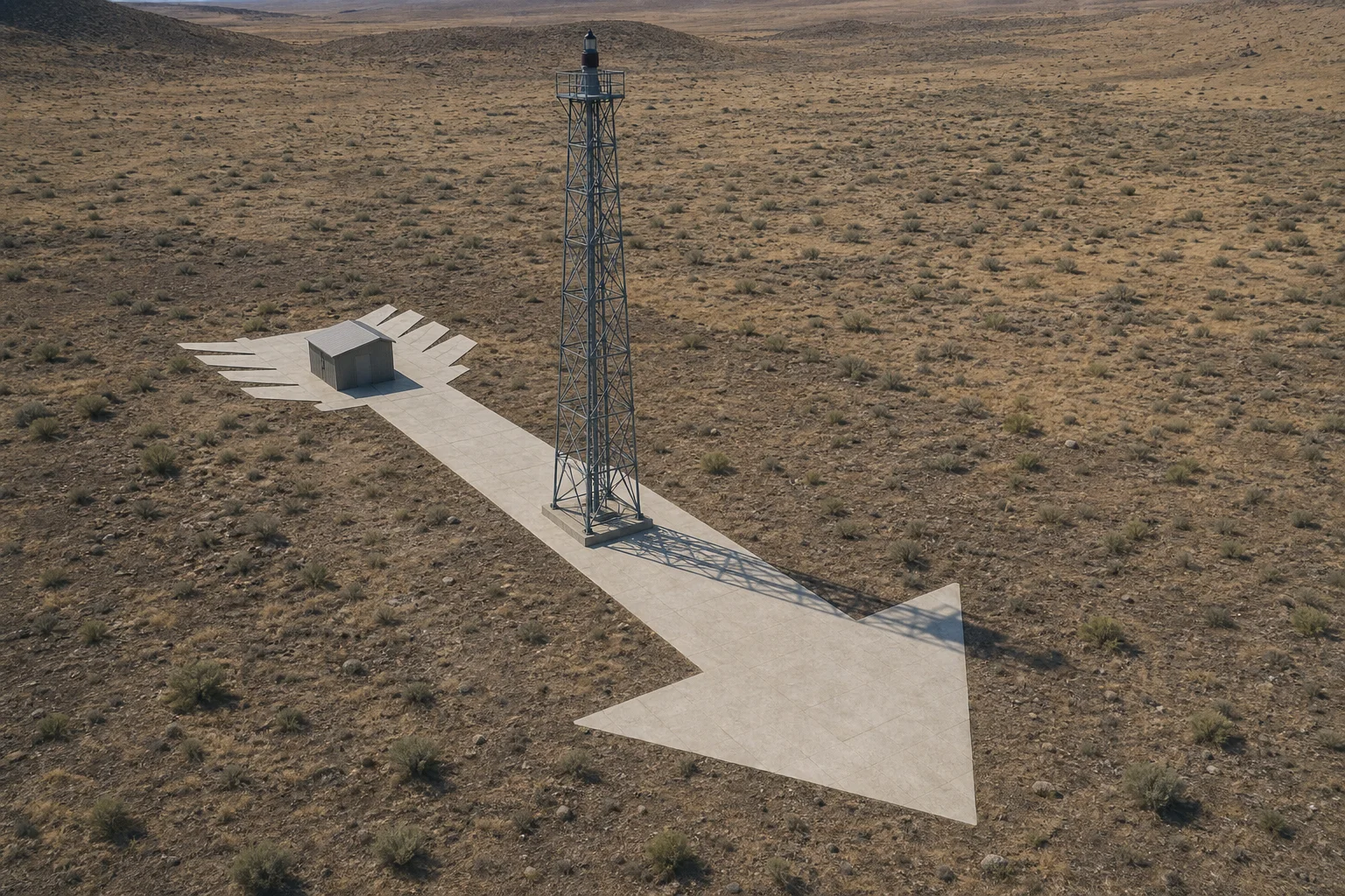
That is why the surviving shapes can feel so delightfully oversized. They were not signs for motorists. They were a high-contrast, pilot-facing instruction written at landscape scale, intended to be read from above when a moving aircraft did not have the luxury of stopping to ask for directions.
A chain of small lighthouses
The concrete arrows were only one part of a network. The Air and Space Museum says that the 1926 Air Commerce Act accelerated beacon construction, and that acetylene-powered beacons with Fresnel lenses appeared along air-mail airways. By 1946, it reports, 2,112 beacons operated on 124 U.S. airways.
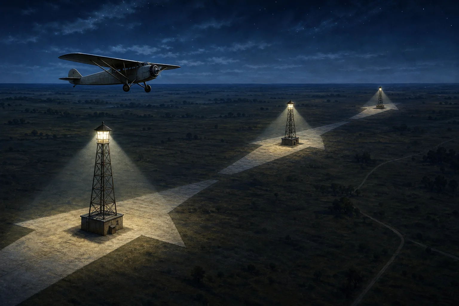
It is tempting to describe the arrows as relics from a time before navigation existed. The more interesting truth is that they were navigation: an ambitious, visible network made from light, concrete and a pilot’s ability to see the next point in the chain. Radio navigation gradually made the beacons obsolete, and the Smithsonian says the last federal airway beacon was decommissioned in 1972. Some towers and arrows remain, though, turning up as quiet reminders that the first national air routes once had to be drawn directly onto the land.
Sources
- Federal Aviation Administration, “The Foundation” — standard beacon-tower dimensions, spacing and concrete-arrow arrangement.
- National Air and Space Museum, “Lighthouses” — history of lighted airways, arrows and the last federal beacon.
- National Air and Space Museum, “A Guiding Light: The Airway Beacon Tower” — early night-flying context and the scale of the beacon network.
- National Air and Space Museum, “How Did Air Mail Pilots Find Their Way?” — visual navigation and early lighted-airway context.
Leave a Reply