Category: Unusual Places

  • The Alaska Tunnel Where Trains and Cars Take Turns

    The Alaska Tunnel Where Trains and Cars Take Turns

    In Alaska, one mountain tunnel switches between rail and road traffic. The Anton Anderson Memorial Tunnel reaches Whittier through Maynard Mountain, and its single lane serves cars and trains in scheduled turns. A rail line runs directly beneath the roadway, giving the passage a rare double life.
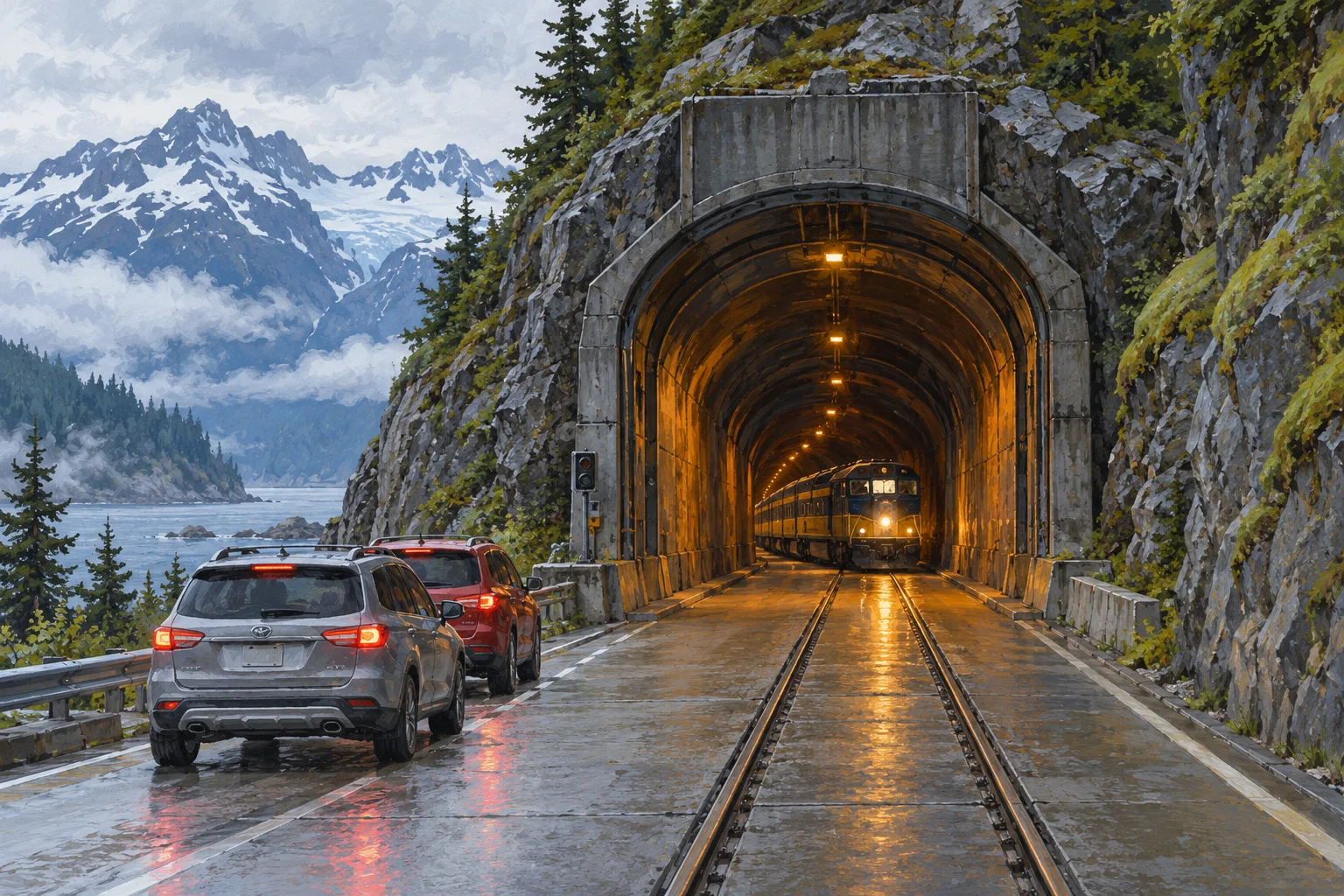
    Editorial illustration of a train and cars taking turns through Alaska's shared rail-and-road mountain tunnel.
    Editorial illustration of the Anton Anderson Memorial Tunnel’s shared rail-and-road design.

    A wartime rail link through the mountain

    The route began as a railroad project. In 1941, the U.S. Army started building a rail spur between Whittier and Portage, with Army engineer Anton Anderson leading the work. The line connected a deep-water port on Prince William Sound to Alaska’s rail network. Workers completed the spur on April 23, 1943; it included a 2.5-mile tunnel through Maynard Mountain.

    The Alaska Department of Transportation’s project history describes Whittier’s role as a supply link during World War II. The tunnel later carried rail traffic while Whittier developed as a port and community.

    Turning a railroad tunnel into a road

    For decades, the railroad helped vehicles cross the mountain by loading them onto flatcars. A later highway project sought a more direct connection to Whittier. Rather than build a separate highway tunnel, engineers adapted the existing passage for alternating rail and vehicle use.

    During the winter of 1998–1999, crews replaced the original rail ties and ballast with precast concrete driving panels. The panels fit around the rails, leaving the track flush with the roadway. According to the state’s virtual drive guide, this arrangement lets a single lane of automobiles travel over the railroad-track area, with trains and vehicles taking turns.
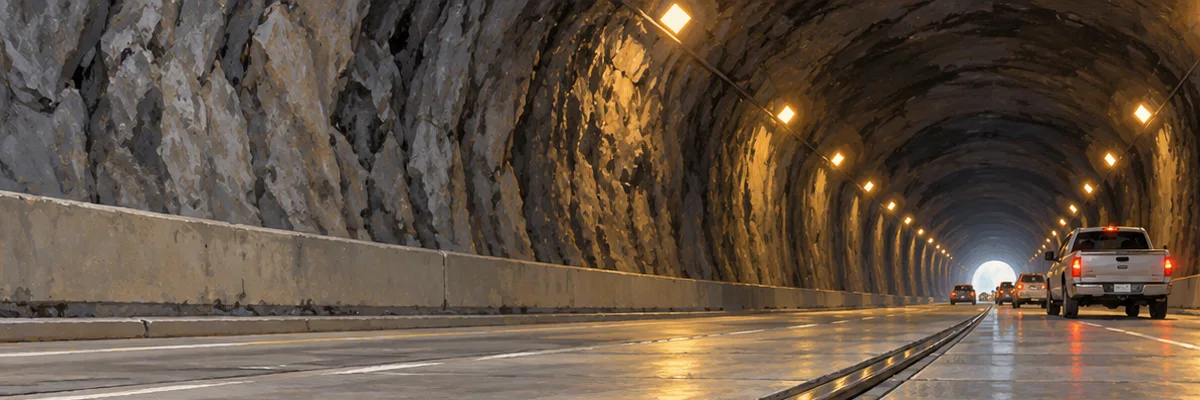
    Editorial illustration of embedded rails running flush through a paved roadway inside a mountain tunnel.
    Editorial illustration of the embedded track and driving surface inside the tunnel.

    A timetable shared by cars and trains

    At the tunnel’s staging areas, vehicles wait for their scheduled opening. Operators manage the direction and type of traffic so the narrow passage is used by one movement at a time. The state describes the tunnel as operating for highway use during much of the day, while rail service uses assigned periods.

    That makes a trip through the mountain part of the engineering story: the roadway depends on the same corridor as the railroad, and the schedule coordinates both. The state’s frequently asked questions explain that the highway project was selected after engineering and economic studies as a cost-effective dual-use design.

    A practical passage with an unusual second job

    Today, the tunnel links Whittier with the Portage Glacier Highway. Its name honors Anton Anderson, the chief engineer whose work helped bring rail access to the port; the state dedicated the tunnel to him in 1976. One corridor now continues that connection by hosting two kinds of travel, with a roadway resting over the rails until the next train’s turn.

    Sources

  • Wyoming’s Avenue of Rocks Looked Like a Sea Serpent to Trail Travelers

    Wyoming’s Avenue of Rocks Looked Like a Sea Serpent to Trail Travelers

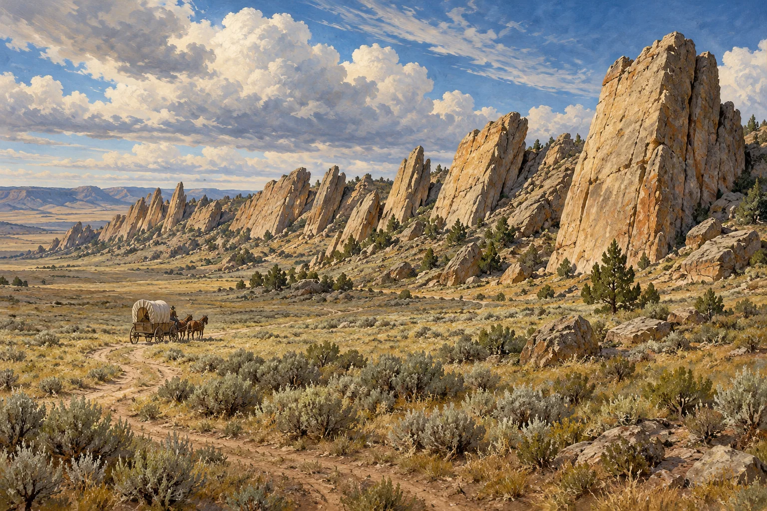
    Editorial illustration of a covered wagon approaching the jagged sandstone ridge at Wyoming’s Avenue of Rocks
    Editorial illustration of Avenue of Rocks and the trail corridor.

    West of Casper, Wyoming, a mile-long ridge of sandstone rises from the high plains in a line of tilted slabs. To 19th-century travelers, the formation looked like the backbone of an enormous animal. They called it Devil’s Backbone, Avenue of Rocks, Rock Avenue, or Rock Lane—and then guided their wagons through the narrow passage beside it.

    The ridge is a natural landmark on the routes followed by the Oregon, California, Mormon Pioneer, and Pony Express trails. National Park Service records describe it as a conspicuous feature that emigrants sketched and discussed in their journals. Its broken sandstone beds were pushed up by pressure in the Earth’s crust, leaving a mile of stone fins that still stand out against the surrounding grassland.

    A sea-serpent shape on the western trail

    British traveler Richard Burton passed the landmark by stagecoach in 1860. He compared its upturned sandstone to the vertebrae of a great sea serpent. That image fit a feature that rose like a jagged spine across a landscape of open sky, sagebrush, and long travel days.

    The formation was more than a view. The trail narrowed as it passed between the rocks and a ridge to the east, and the sandstone made the crossing memorable enough to appear in emigrant accounts. A National Park Service itinerary for the region traces the historic trail corridor west from Casper and identifies the surviving signature of emigrant W. H. Stephens at Avenue of Rocks.

    Editorial illustration of a weathered trail journal beside a pencil sketch of a jagged Wyoming ridge
    Editorial illustration: a traveler records the distinctive ridge in a journal.

    Helen Carpenter’s windy passage

    Helen Carpenter traveled through the area with her family in June 1857. In her journal, she focused on the wind, which made walking difficult and whipped the women’s skirts around. Some companions tried weighing their hems with stones. Carpenter later recalled that the improvised weights left bruises on their shins, a wry detail that gives the trail a human scale.

    Her account makes the place feel immediate: the rocks gave the route its shape, while the Wyoming wind shaped the travelers’ small daily decisions. The ridge could be both a geological formation and a scene of practical problem-solving.

    Marks left in stone

    Some travelers carved their names into the sandstone as they passed. Weathering and road construction later erased many inscriptions, while faint carvings remain on a few rock faces protected by overhangs. The National Park Service notes that the site is managed by the Bureau of Land Management and asks visitors to preserve its historical character by leaving the rocks unmarked.

    Today, the ridge remains a striking landmark west of Casper: a row of sandstone pushed upright by ancient forces, remembered by people who crossed the plains, and still legible in the contours of the trail landscape. Its unusual shape invited comparisons to a sea creature; the journals and surviving traces show how travelers made the place part of their own record.

    Sources

  • St. Paul’s UFO Landing Pad Put Small-Town Ingenuity on the Map

    St. Paul’s UFO Landing Pad Put Small-Town Ingenuity on the Map

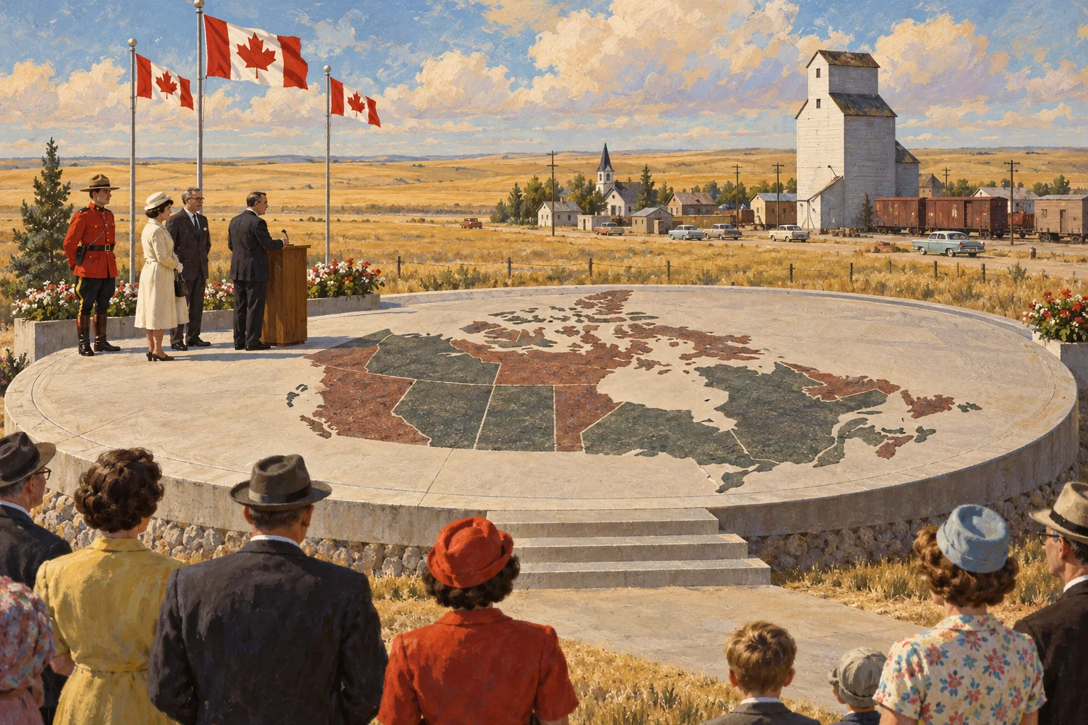
    A prairie town welcomed Canada’s centennial with an invitation aimed at the stars: a raised concrete landing pad for visiting flying saucers. St. Paul, Alberta, turned the 1967 project into a lasting landmark—and a snapshot of the community’s inventive centennial spirit.

    The pad stands beside the recreation grounds in St. Paul, northeast of Edmonton. The Town of St. Paul dates its opening to June 3, 1967, and says the occasion also brought the title “Centennial Capital of Canada.” The municipal history calls it the world’s first UFO landing pad; the St. Paul Museum places it among a much larger set of local projects created for Canada’s 100th birthday.

    A town makes a hundred centennial projects

    St. Paul’s centennial work began years before the anniversary. The museum’s historical record says the community started preparing in 1964, with its Chamber of Commerce leading a program that eventually grew to 100 projects. The collection ranged from a recreation building and student exchanges to local arts, farm machinery, Ukrainian folk dancing and a community time capsule.

    The landing pad had its own place in that catalog: project 65. Its neighbors in the list hint at a whole town leaning into the cosmic theme. Project 66 was a landing-pad float, project 67 offered flying-saucer tokens, and a later entry promised “Martian Hairdos.” The pad was both a playful attraction and one piece of an ambitious civic celebration.

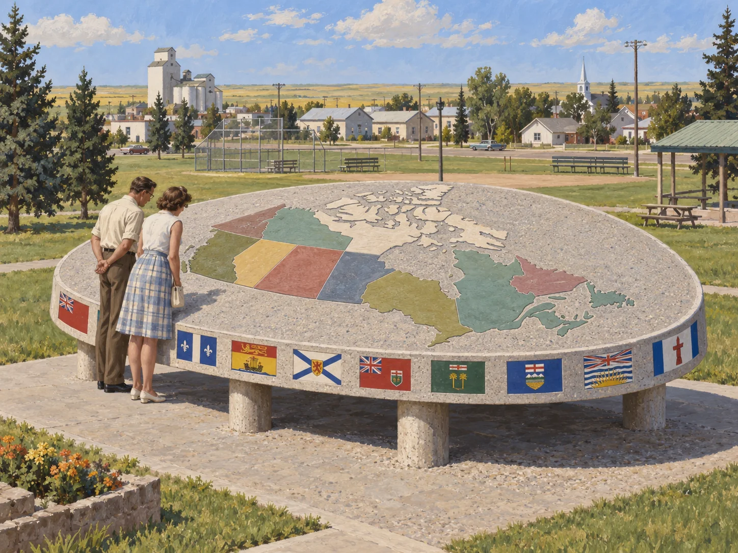
    Editorial illustration of visitors studying a map of Canada inset into St. Paul’s raised UFO landing pad.
    Editorial illustration: the platform’s map of Canada made the welcome a distinctly national one.

    An engineer gave the invitation a shape

    Alberta’s engineering association identifies Edmonton civil engineer Alex Mair as the pad’s designer. Its account describes an oval platform raised above the ground, with a large map of Canada and blinking lights intended to guide visitors. The association gives the structure’s weight as 130 tonnes, a substantial piece of civic engineering for an idea delivered with a wink.

    The municipal site places the pad’s opening on June 3, 1967. Its present-day description connects the attraction with a tourist information centre and a welcome for visitors. In the 1990s, the Town says, Mayor Paul Langevin opened an adjacent centre. The site now describes that visitor hub as home to a boutique representing more than 50 local artisans.

    More than a landing strip

    The pad’s design made the joke visible from the road, while its map and flags framed it as a place for the whole country. That combination fits the broader centennial record preserved by the museum: practical buildings, cultural projects, ambitious community plans and a few ideas meant to make people smile.

    St. Paul’s landmark still offers a compact way to meet that history. It is a piece of concrete engineering, a tourist stop and a surviving artifact of the town’s 1967 celebration. The invitation remains legible in the monument itself: a small Alberta community made room on the map for anyone curious enough to stop.


    Sources: Town of St. Paul, “The Landing Pad”; St. Paul Museum, “Centennial Projects”; APEGA, “Calling All Flying Saucers: Free Parking in St. Paul”.

  • Switzerland’s Brusio Viaduct Lets a Train Loop Over Its Own Track

    Switzerland’s Brusio Viaduct Lets a Train Loop Over Its Own Track

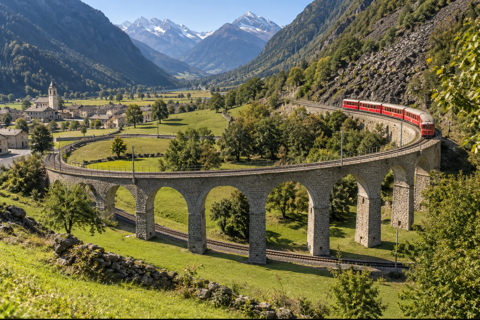
    A train near Brusio, Switzerland, takes a route that looks like a railway trick: it curves around in a full loop, climbs over its own track, and continues through the Alps. The stone viaduct makes the Bernina Railway’s ingenious answer to steep terrain visible in a single view.

    The Brusio circular viaduct stands on the Bernina line of the Rhaetian Railway. Its nine stone arches carry the train around a 360-degree turn, with one level passing above another. From the carriage, passengers can look down at the track they crossed moments earlier. From the valley, the railway draws a clear circle across the hillside.

    The municipality of Brusio describes the train slipping beneath one of the arches as it completes the loop. Graubünden Tourism maps a 1.9-kilometre walk from the station to the viaduct and back through the village centre, with an estimated route time of 35 minutes. It is a small bridge with a big visual payoff: the railway seems to fold back on itself in open air.

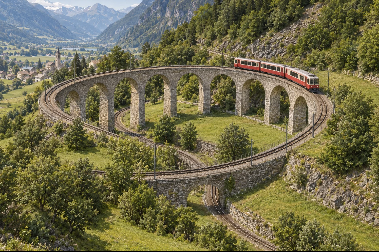
    Editorial illustration of a red-and-cream train climbing the curved stone arches of the Brusio viaduct and crossing above its lower track.
    Editorial illustration: the loop lets the railway gain elevation while remaining part of the open alpine landscape.

    A loop turns a steep climb into a longer route

    The Bernina Railway connects Tirano, Italy, with St. Moritz, Switzerland, crossing the Bernina Pass. The Brusio municipal account describes the route’s early engineering challenge: designers had to gain height across short distances while keeping the line’s scenic character in view. The railway uses tunnels for some difficult turns; at Brusio, the hillside allowed an open-air spiral instead.

    That geometry gives the train more track over which to climb. Rather than rising sharply in one short stretch, it follows a curve around the valley and reaches a higher level gradually. The line crosses over itself at the viaduct, and a train can continue its journey without a rack railway. The municipality highlights that the Bernina line crosses the Alps without a base tunnel or a high-level summit tunnel, making its visible mountain route part of the engineering story.

    The viaduct is one expressive detail in a larger railway landscape. Brusio’s municipal heritage page places it among the Bernina Railway’s major attractions and identifies the railway as part of UNESCO’s World Heritage. Across the Alps, the line brings villages and mountain regions into the same journey.

    Built for the journey, admired from the valley

    The municipality describes the engineering challenges around Brusio during 1908–1910, when the Bernina Railway’s builders worked across steep terrain and tight elevation changes. Their solution at Brusio remains easy to read from the valley: stone arches carry the track around the hillside and back above itself.

    Visitors can experience the curve from both perspectives. On the train, the track passes beneath the carriage as the line completes its turn. On foot, a short circular route from Brusio station reaches the viaduct and returns through the village. Switzerland Tourism describes the walk as a roughly 30-to-40-minute outing, with views of the railway and the surrounding Valposchiavo.

    The loop is memorable because its purpose and spectacle are the same thing. A tight turn solves a practical problem of mountain travel, while the open arches let everyone nearby see how the solution works. As the train rounds the curve, the railway becomes its own moving diagram: one track below, another above, and the Alps all around.


    Sources: Comune di Brusio, “Viadotto di Brusio”; Switzerland Tourism, “Brusio Spiral Viaduct”.

  • How Mitchell’s Corn Palace Turns Harvest Into Annual Folk Art

    How Mitchell’s Corn Palace Turns Harvest Into Annual Folk Art

    In Mitchell, South Dakota, a harvest celebration grew into a building dressed for the occasion. The Corn Palace began in 1892 as a way to show visitors the region’s agricultural promise. More than a century later, its walls still turn local crops into large-scale pictures, refreshed each year by designers and a crew of workers.

    The idea paired civic hospitality with a practical display: bring city residents and their rural neighbors together at harvest time, then let the region’s produce decorate the gathering place. The first palace stood on Main Street. Its successor arrived in 1905, and Mitchell committed to a permanent structure in 1919. The present building opened in 1921, carrying the festival forward while also serving the community as an arena and event hall.

    A mural assembled one kernel at a time

    Each year brings a new mural theme and a fresh arrangement of naturally colored corn, grains, and native grasses. The Corn Palace describes using a dozen colors or shades of corn. The kernels are attached ear by ear, while other plants frame and enrich the pictures.

    Workers arrange colored corn kernels and native grasses into a large mural panel for a prairie folk-art building
    Editorial illustration — the collaborative craft behind an annual crop-art mural.

    The design work starts well before the harvest material is ready. A local committee selects a theme, and Dakota Wesleyan University students in digital media and design courses create the mural concepts with faculty guidance. A local farmer grows the corn, and a team of roughly 20 workers installs the new panels as crops become available in late summer.

    The work follows the agricultural calendar. Crews begin preparing the building in late spring; new corn murals are typically completed between late August and early October. Growing conditions shape the schedule, so the changing facade reflects both an artistic plan and the year’s crop.

    A civic hall with a crop-art exterior

    The Corn Palace’s unusual combination is the point: its seasonal decoration turns an agricultural exhibit into public art, while the building remains useful year-round. The venue hosts gatherings, performances, school events, and basketball. The permanent palace was completed in time for the 1921 festivities, and Mitchell hosted its first boys’ state basketball tournament there that winter.

    That blend of harvest display and community space explains why the tradition endured. The palace gives local artists a large canvas, gives area crops a starring role, and gives the city a shared landmark whose details change with each new mural season.

    Sources

  • San Francisco’s Wave Organ Lets the Bay Play the Pipes

    San Francisco’s Wave Organ Lets the Bay Play the Pipes

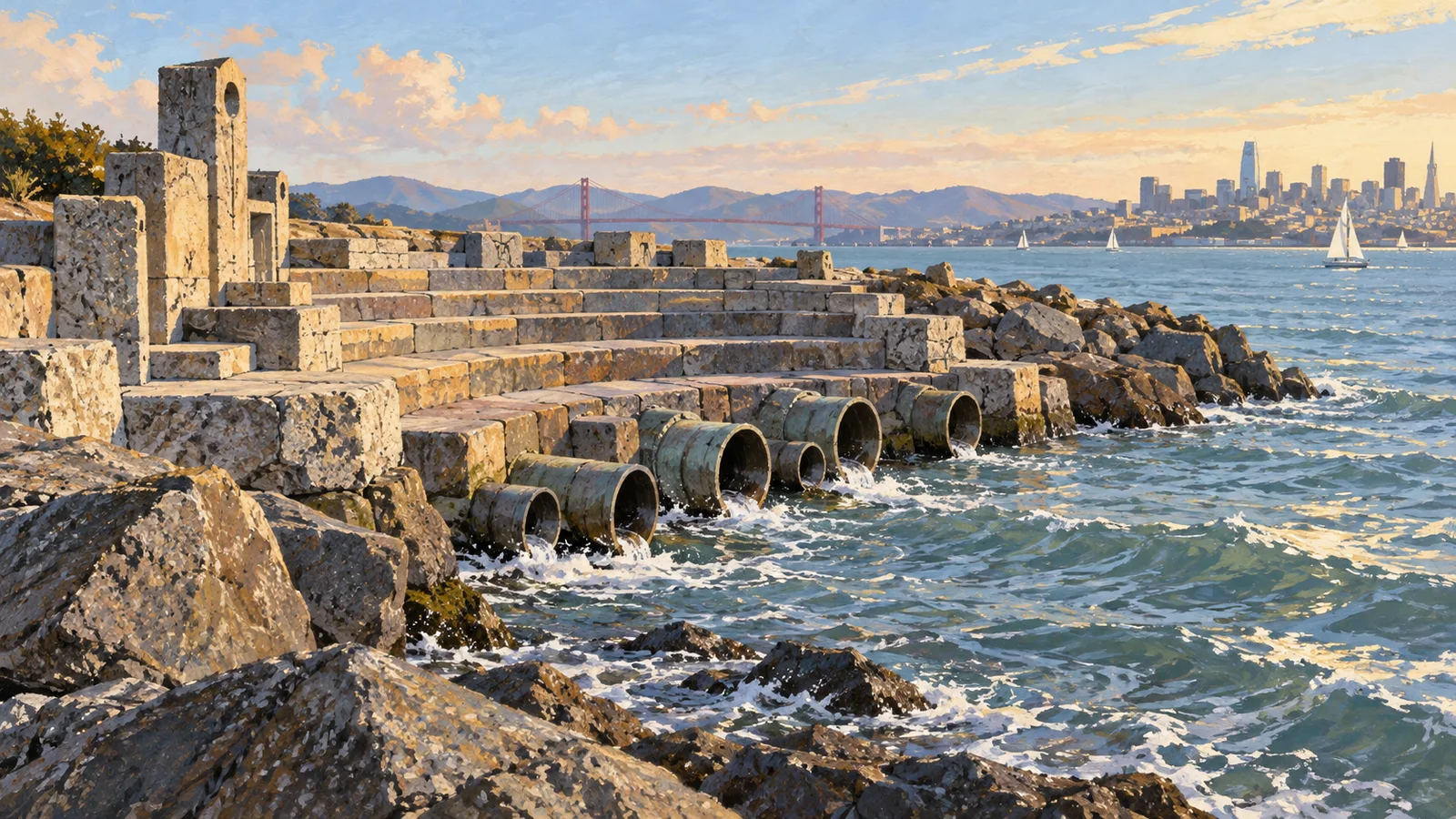
    At the edge of San Francisco Bay, the Wave Organ gives the water a set of pipes to play. The public sculpture at the Marina Breakwater changes its sound as waves move through 25 pipes set at different heights in stone.

    A sculpture shaped for the shoreline

    A 2008 staff report from California’s State Coastal Conservancy describes the Wave Organ as a project developed by Exploratorium artist Peter Richards with sculptor and master stonemason George Gonzalez, and installed in 1986. Its listening area has stone benches and steps, with 25 PVC and concrete pipes set at different elevations.

    The setting is part of the design. The Exploratorium’s archived exhibit page says granite building material already at the jetty was used in the sculpture. Different-length listening pipes extend from the seating areas toward the water, joining the stone terraces to the bay.

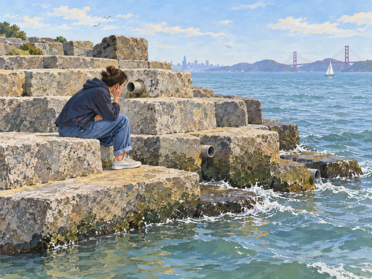
    Editorial illustration of a visitor listening beside a pipe at San Francisco’s Wave Organ, with bay water around the stone jetty.
    Editorial illustration: a visitor listens beside one of the Wave Organ’s pipes.

    When the tide moves, the organ answers

    At high tide, water moving in and out of the pipes produces sound. The Exploratorium describes a wave-activated instrument whose sound changes in intensity and complexity with the tides and weather. Each pipe sits at a different height, so the water and air interact with the sculpture as the bay shifts.

    The result belongs to its place. A changing tide supplies the movement, and the pipes turn that movement into a waterfront soundscape. The Wave Organ makes the bay’s everyday motion something a listener can pause and hear.

    Sources

  • Why the Giant’s Causeway Looks Like a Stone Puzzle

    Why the Giant’s Causeway Looks Like a Stone Puzzle

    A volcanic pattern with a giant-sized legend

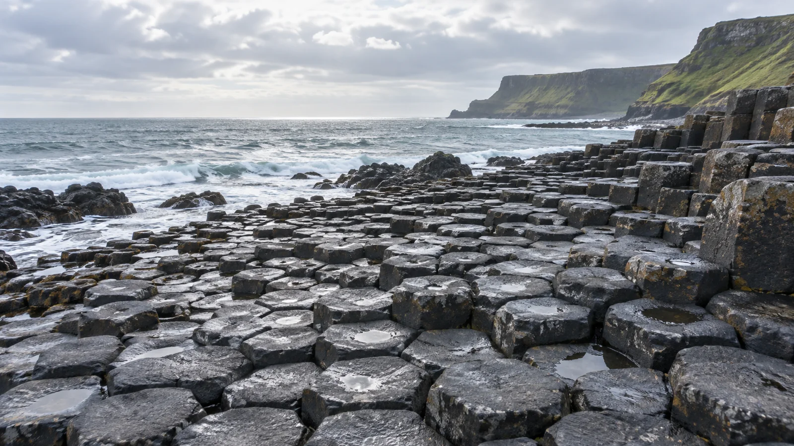
    On Northern Ireland’s exposed Atlantic coast, thousands of dark stone columns fit together like an immense natural pavement. Their regular geometry is striking enough to have inspired a giant’s legend. The documented story behind the Giant’s Causeway is just as remarkable: lava, cooling, fracture, erosion and time produced one of the world’s clearest displays of columnar basalt.

    Editorial illustration of dark polygonal basalt columns meeting the Atlantic coast at the Giant’s Causeway.
    Editorial illustration of the Giant’s Causeway’s columnar basalt landscape.

    A pavement made by cooling rock

    The British Geological Survey describes the Causeway as an exceptional display of columnar basalt lava. The site contains around 40,000 large, regularly shaped columns, creating the familiar stepped formations along the coast.

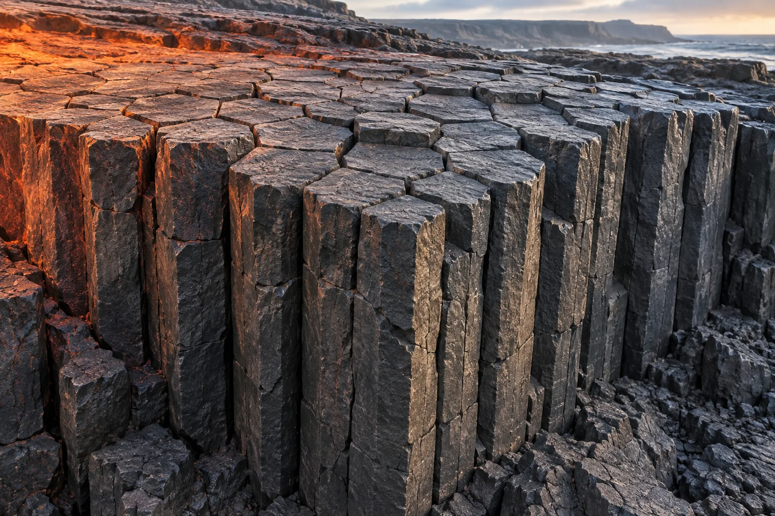
    The columns formed during volcanic activity roughly 50 to 60 million years ago. As lower layers of lava cooled, the rock contracted and cracked. Those fractures organized into the repeating polygonal pattern that gives the landscape its deliberate-looking geometry. Many columns have six sides, though natural cooling creates a family of related shapes rather than a machine-perfect grid.

    How the pattern reached the sea

    The National Trust’s geological history traces a longer sequence. Volcanic eruptions spread basalt across an older landscape. Erosion later cut valleys through the rock, and further lava filled some of those valleys. Glaciers and coastal waves then removed and exposed layers, revealing the close-packed columns visitors see today.

    That combination of internal structure and coastal erosion makes the Causeway visually unusual. It reads as a built surface at human scale, while its construction happened deep within cooling lava over a geologic timescale.

    Editorial illustration of interlocking dark basalt columns with polygonal tops and vertical fractures.
    Editorial illustration showing the columnar fracture pattern created as basalt cools.

    Folklore keeps the shape alive

    For centuries, the formation has also carried the story of the Irish giant Finn McCool, whose legendary causeway reaches toward Scotland. The folklore gives the landscape an imaginative companion, while the geological account explains its physical origin. Both begin with the same memorable sight: an enormous field of interlocking stone steps at the edge of the sea.

    The Giant’s Causeway has mattered to earth science as well as storytelling. Geological studies of the coastline’s exposed layers have helped explain the sequence of volcanic and erosional events in the region. It remains a rare place where a single, walkable pattern makes deep-time processes easy to see.

    Sources

  • The Mailbox at the Bottom of Susami Bay

    The Mailbox at the Bottom of Susami Bay

    In Susami Bay, Japan, a red postbox sits 10 meters below the sea. Divers can drop a waterproof postcard into it, where an authorized collector retrieves the mail for the ordinary postal system on shore.

    A bright red postbox anchored on the seabed of Susami Bay while a diver approaches with a waterproof postcard
    Editorial illustration: the underwater postbox in Susami Bay.

    Most mailboxes ask you to walk to the curb. Susami’s asks you to descend through clear seawater.

    The unusual box is in Susami Bay, off the coast of Wakayama Prefecture in Japan. Guinness World Records’ record entry lists it as the world’s deepest underwater postbox, at 10 meters (32 feet 9 inches) beneath the water. The record page dates the entry to April 23, 1999, and says the box is officially part of the Susami post office.

    The confirmed part: it accepts real mail

    The mailbox is an active collection point on the seafloor. Guinness records that sports divers can post mail there using special waterproof plastic postcards. The same entry says authorized employees open the box with post-office keys. More than 4,273 pieces of undersea mail were collected during its first year of operation.

    Susami Town’s own tourism guidebook describes the local “underwater post” as a landmark 10 meters below the sea and says that a special postcard deposited there can be sent around the world. The guidebook places the experience alongside guided diving and other marine activities, making the mailbox a piece of local infrastructure and a community attraction at the same time.

    A cutaway view of a red underwater postbox, a diver with a waterproof postcard, and a shoreline collection point
    Editorial illustration: a diver’s postcard follows a short but memorable route from seabed to shore.

    How underwater mail gets dry-land treatment

    The strange part is the setting; the mail follows a familiar postal process. A diver carries the waterproof card down to the anchored box and places it inside. An authorized collector later opens the box, brings the cards back to shore and puts them into the normal delivery stream. The message begins its journey under the sea, and the postal network takes over above water.

    That distinction also explains why the box needs special cards. Ordinary paper is a poor match for salt water, pressure and handling by a diver. The record authority specifies waterproof plastic postcards, while Susami’s guidebook directs visitors to use a dedicated postcard. The documented practice is specific: divers use the approved waterproof card for this unusual collection point.

    The box’s depth is impressive, but its design is practical. It is anchored in a shallow coastal dive rather than suspended in the open ocean. A diver can reach it, place the card through the slot and return to the surface; the collector’s work then connects the novelty to a regular post office.

    Folklore, record language and what the sources actually say

    Popular lore: travel stories often call Susami’s box an “underwater post office.” That phrase captures the fun of the experience, while the documented object is a postbox and collection point officially linked to the Susami post office. A diver really can send a card from the seafloor.

    Record claim: Guinness World Records lists the Susami installation as the deepest underwater postbox. Record titles can change, so this article uses the scope stated by Guinness rather than treating “deepest” as a permanent fact about every underwater mailbox ever built.

    Speculation: the sources establish a functioning local mail point, special waterproof cards, authorized collection and a 10-meter dive. They leave the mailbox’s original motivation and each card’s exact route open, which keeps the documented story precise.

    A coastal Susami community prepares waterproof postcards and scuba gear while the red underwater mailbox waits offshore
    Editorial illustration: preparing the postcard is part of the community’s seaside ritual.

    Why build a mailbox underwater?

    Because a place can make an ordinary act memorable. Susami’s guidebook presents the mailbox with its diving programs and seaside activities, showing how the installation fits into the town’s public identity. A postcard is already a small invitation to imagine another place; posting one from below the surface turns the trip itself into part of the message.

    The result is a peculiar meeting of systems: a metal box designed for salt water, a diver working in a calm bay, a waterproof card and a conventional post office on land. The route is only a few minutes long, but it makes the ocean feel like an address.

    Sources