Author: Jacob

  • The Big Bend Tablet Mystery Began With a Family, a Crevice and a Handful of Mud

    The Big Bend Tablet Mystery Began With a Family, a Crevice and a Handful of Mud

    In 1962, a family exploring the Hot Springs area of Big Bend National Park fitted together fragile mud fragments covered with unfamiliar marks. The find became a decades-long mystery, and the park’s own records preserve a careful lesson in how strange evidence should be handled.

    A family examines a fragile mud tablet beside a desert river in Big Bend
    Editorial illustration of the family examining the fragments near Tornillo Creek.

    The discovery began with a small movement in a very big landscape. During the winter of 1962, Donald Uzzell was climbing along a cliff above Tornillo Creek, opposite the Hot Springs Post Office and Motel. In an L-shaped cleft, he found a stack of pieces that looked like parts of a clay tablet. He passed the fragments down to the rest of his group—his mother and stepfather, Bernice and Charles Nickles, and his wife, Reva Uzzell—and they assembled the pieces like a jigsaw puzzle.

    The assembled object carried more than 70 marks. Family members photographed it, then brought the pieces to Big Bend National Park headquarters at Panther Junction. That handoff placed an ordinary family outing at the center of a question that would travel through park files, university correspondence and magazine pages for years.

    A park naturalist saw a different clue

    Douglas Evans, the park’s chief naturalist in 1962, examined the fragments. In a letter preserved by the National Park Service, Evans described material made from sun-baked mud peeled from a recently soaked flat along Tornillo Creek after a flood. He recalled that the surface looked fresh, showed very little weathering and crumbled with handling. The pieces eventually broke down into dust while they were stored at the park.

    A close view of a sun-baked mud tablet with hand-drawn marks beside a field notebook
    Editorial illustration of the fragile material and its simple marks.

    Those physical observations form the strongest evidence in the surviving record. A fragile sheet of river mud with a fresh-looking surface fits a recent mark-making episode. The park’s account says people who saw the object in the office found no archaeological or historical significance in it. Ross Maxwell, Big Bend’s first superintendent, later wrote that conversations with people who had been children around Hot Springs before 1964 supported the possibility of a child making marks in the mud with a stick.

    Why the mystery kept moving

    The family who found the pieces kept asking questions. Bernice and Charles Nickles contacted Lewis R. Church, who shared photographs with a classical-languages scholar at Brigham Young University. That early exchange produced a cautious comparison with an old Greek alphabet. In 1969, the Nickles connected with Jack and Bernice McGee, writers who had taken an interest in reports of unusual inscriptions and objects around the United States.

    From 1969 through 1977, the McGees corresponded with Big Bend staff and academics. In October 1970, they returned to the discovery area with the Nickles, the Uzzells and Miriam Lowrance of Sul Ross University. They collected dust and fragments from the crevice and sent samples to researchers. The expedition shows the human side of the story: people followed a puzzling object across years because its marks seemed to promise a larger history.

    A national park naturalist studies a delicate mud tablet on a tray in a historic office
    Editorial illustration of a park-office examination and the paper trail that followed.

    Some observers continued to read the marks as evidence of an ancient language. The NPS account records suggestions involving Greek, Hebrew, Phoenician and other scripts. In 1977, a translation attributed to Barry Fell described the writing with a mixture of ancient-language names. The park’s historian also records that Fell’s background was marine biology and that his language work was a personal interest.

    What can be said with confidence

    The Big Bend Tablet is a verified historical episode: a named family found fragments in a specific place, photographed them, delivered them to park staff and pursued an explanation. The object itself no longer survives. Its material, its rapid disintegration and the observations of park personnel are documented in the National Park Service record.

    The ancient-inscription reading belongs to the story’s interpretation layer. It appears in correspondence and later claims, while the park’s material observations and local recollections point toward a recent drawing in dried river mud. The evidence invites curiosity and rewards restraint. A family found something genuinely odd; the surviving record helps explain why the oddity became a legend.

    Today, Hot Springs remains a historic district at the confluence of Tornillo Creek and the Rio Grande. Visitors can see preserved structures, ancient pictographs and the spring that shaped the area’s human history. The tablet’s story adds one more human-scale detail to that landscape: a brief set of marks that turned a walk along a creek into a long investigation.

    Sources and further reading

  • The Mailbox at the Bottom of Susami Bay

    The Mailbox at the Bottom of Susami Bay

    In Susami Bay, Japan, a red postbox sits 10 meters below the sea. Divers can drop a waterproof postcard into it, where an authorized collector retrieves the mail for the ordinary postal system on shore.

    A bright red postbox anchored on the seabed of Susami Bay while a diver approaches with a waterproof postcard
    Editorial illustration: the underwater postbox in Susami Bay.

    Most mailboxes ask you to walk to the curb. Susami’s asks you to descend through clear seawater.

    The unusual box is in Susami Bay, off the coast of Wakayama Prefecture in Japan. Guinness World Records’ record entry lists it as the world’s deepest underwater postbox, at 10 meters (32 feet 9 inches) beneath the water. The record page dates the entry to April 23, 1999, and says the box is officially part of the Susami post office.

    The confirmed part: it accepts real mail

    The mailbox is an active collection point on the seafloor. Guinness records that sports divers can post mail there using special waterproof plastic postcards. The same entry says authorized employees open the box with post-office keys. More than 4,273 pieces of undersea mail were collected during its first year of operation.

    Susami Town’s own tourism guidebook describes the local “underwater post” as a landmark 10 meters below the sea and says that a special postcard deposited there can be sent around the world. The guidebook places the experience alongside guided diving and other marine activities, making the mailbox a piece of local infrastructure and a community attraction at the same time.

    A cutaway view of a red underwater postbox, a diver with a waterproof postcard, and a shoreline collection point
    Editorial illustration: a diver’s postcard follows a short but memorable route from seabed to shore.

    How underwater mail gets dry-land treatment

    The strange part is the setting; the mail follows a familiar postal process. A diver carries the waterproof card down to the anchored box and places it inside. An authorized collector later opens the box, brings the cards back to shore and puts them into the normal delivery stream. The message begins its journey under the sea, and the postal network takes over above water.

    That distinction also explains why the box needs special cards. Ordinary paper is a poor match for salt water, pressure and handling by a diver. The record authority specifies waterproof plastic postcards, while Susami’s guidebook directs visitors to use a dedicated postcard. The documented practice is specific: divers use the approved waterproof card for this unusual collection point.

    The box’s depth is impressive, but its design is practical. It is anchored in a shallow coastal dive rather than suspended in the open ocean. A diver can reach it, place the card through the slot and return to the surface; the collector’s work then connects the novelty to a regular post office.

    Folklore, record language and what the sources actually say

    Popular lore: travel stories often call Susami’s box an “underwater post office.” That phrase captures the fun of the experience, while the documented object is a postbox and collection point officially linked to the Susami post office. A diver really can send a card from the seafloor.

    Record claim: Guinness World Records lists the Susami installation as the deepest underwater postbox. Record titles can change, so this article uses the scope stated by Guinness rather than treating “deepest” as a permanent fact about every underwater mailbox ever built.

    Speculation: the sources establish a functioning local mail point, special waterproof cards, authorized collection and a 10-meter dive. They leave the mailbox’s original motivation and each card’s exact route open, which keeps the documented story precise.

    A coastal Susami community prepares waterproof postcards and scuba gear while the red underwater mailbox waits offshore
    Editorial illustration: preparing the postcard is part of the community’s seaside ritual.

    Why build a mailbox underwater?

    Because a place can make an ordinary act memorable. Susami’s guidebook presents the mailbox with its diving programs and seaside activities, showing how the installation fits into the town’s public identity. A postcard is already a small invitation to imagine another place; posting one from below the surface turns the trip itself into part of the message.

    The result is a peculiar meeting of systems: a metal box designed for salt water, a diver working in a calm bay, a waterproof card and a conventional post office on land. The route is only a few minutes long, but it makes the ocean feel like an address.

    Sources

  • The Fish With a Transparent Head Can Rotate Its Eyes to Eat

    The Fish With a Transparent Head Can Rotate Its Eyes to Eat

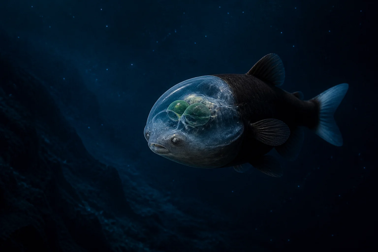
    Deep in the Pacific, a small fish carries a clear dome over its head. Its green tubular eyes usually point upward, then rotate forward when dinner arrives.

    A Pacific barreleye fish drifting through dark water with green tubular eyes visible inside a transparent head dome
    Editorial illustration of a barreleye fish in the deep ocean.

    At first glance, the barreleye looks as if someone put a glass helmet on a fish. The resemblance is real enough to be useful: Macropinna microstoma has a transparent, fluid-filled dome over the top of its head, and its bright green, tubular eyes can be seen inside it.

    The fish lives in the ocean’s twilight zone, generally between about 2,000 and 2,600 feet (600 to 800 metres) in the northeastern Pacific, according to the Monterey Bay Aquarium. At that depth, sunlight has faded to a thin suggestion. A fish that wants to find food needs a very different visual strategy from one cruising near the surface.

    The barreleye’s strategy begins with looking up. Its sensitive eyes point toward the water above, where the silhouettes of small animals can stand out against the faint light filtering down from the surface. The transparent dome lets those eyes work inside a protected space rather than sitting exposed on the outside of the head.

    The eyes turn toward the meal

    For years, scientists observing barreleyes thought the eyes were fixed in an upward position. That created an obvious puzzle: if the fish spotted a possible meal overhead, how could it see the meal once it turned to feed?

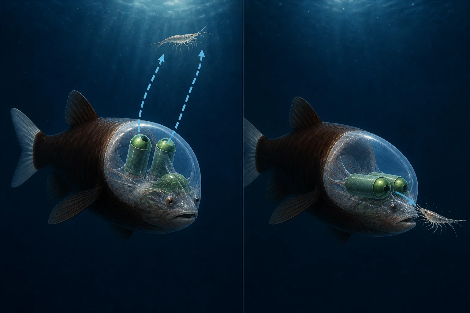
    In 2009, researchers at the Monterey Bay Aquarium Research Institute used video from remotely operated vehicles to document the answer. The fish can rotate its tubular eyes from their usual upward position toward the front of the head. A fish that spends much of its time scanning the ceiling of the ocean can therefore shift its view when it brings food close.

    That movement is easy to describe but strange to picture. Imagine walking through a dark room while looking at the ceiling, then swivelling your eyes forward without turning your head when you reach for a snack. The barreleye’s transparent head is part of the same arrangement: it gives the eyes room to move while keeping their delicate surfaces shielded.

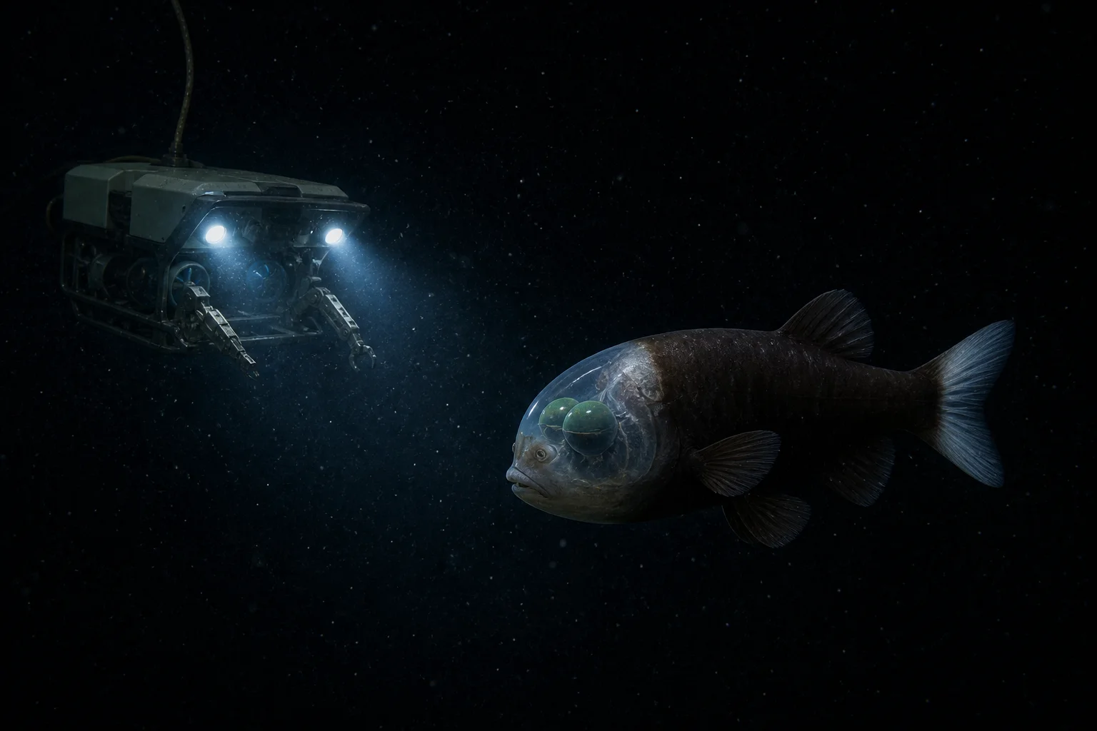
    A remotely operated vehicle observing a barreleye fish in dark deep-sea water
    Editorial illustration of a remotely operated vehicle meeting a barreleye in its deep-sea habitat.

    A rare fish made visible by patient machines

    Barreleyes are rare sights, even for researchers who spend years sending cameras into the deep. The Monterey Bay Aquarium says MBARI remotely operated vehicles logged more than 5,600 dives over more than three decades, yet had encountered the fish only nine times as of 2022.

    That scarcity helps explain why a familiar-looking fish can still hold a scientific surprise. Early observations gave researchers an incomplete picture because the animals were seen only briefly, far below the surface and under artificial lights. Repeated expeditions and better video made it possible to connect the fish’s odd anatomy with its behavior.

    The ROV does more than make a dramatic picture. It allows scientists to watch an animal without bringing it into a tank, where pressure, light and the surrounding water would be radically different. The aquarium describes its deep-sea encounters as video observations of animals in their habitat, adding movement and context to what specimens alone can show.

    An illustrated barreleye fish looking upward for prey and rotating its tubular eyes forward to feed
    Editorial illustration of the barreleye’s two viewing positions: upward scanning and forward feeding.

    Inside the clear dome

    The dome is a transparent, fluid-filled structure that covers the eyes and upper part of the head. The visible green tubes are the eyes; the small spots on the front of the fish’s face are its nostrils, or nares.

    The fish’s appearance also comes with an important limit on what researchers can say. Scientists know the barreleye’s upward gaze helps it detect prey above and that its eyes rotate forward for feeding. They have proposed additional advantages, including protection from stinging siphonophore tentacles, but the aquarium presents those ideas as hypotheses rather than settled facts.

    That distinction is part of the animal’s appeal. The barreleye’s transparent head, periscope-like eyes and daily view of a dark water column make it extraordinary on their own. A camera lowered into that darkness revealed a fish whose strangest feature is also a carefully tuned solution to life where almost no light reaches.

    For a human observer, the fish seems built backward. For the barreleye, the arrangement is practical: watch the ceiling, track a meal, turn the eyes, eat, and return to the dark. The clear head is a working adaptation for life in a place where looking up is the difference between finding food and missing it.


    Sources: Monterey Bay Aquarium, Barreleye; Monterey Bay Aquarium, Searching in the dark; Monterey Bay Aquarium, The midwater; NOAA Ocean Exploration, Barreleye Fish.

  • Why Some Desert Dunes Boom Like a Bass Note

    Why Some Desert Dunes Boom Like a Bass Note

    Some desert dunes do something that sounds impossible until you hear the recording: they boom. At certain places, when a sheet of dry sand slides down a steep slope, the dune can produce a deep, sustained note—more like a distant aircraft or a giant bass speaker than a pile of loose grains.

    The sound is documented at a small number of dune fields. The National Park Service lists Kelso Dunes in California’s Mojave National Preserve among them, and says only seven known sand-dune fields in North America produce the booming effect. At Great Sand Dunes National Park and Preserve in Colorado, the agency invites visitors to listen for “singing sands,” a natural sound made during an avalanche of sand.

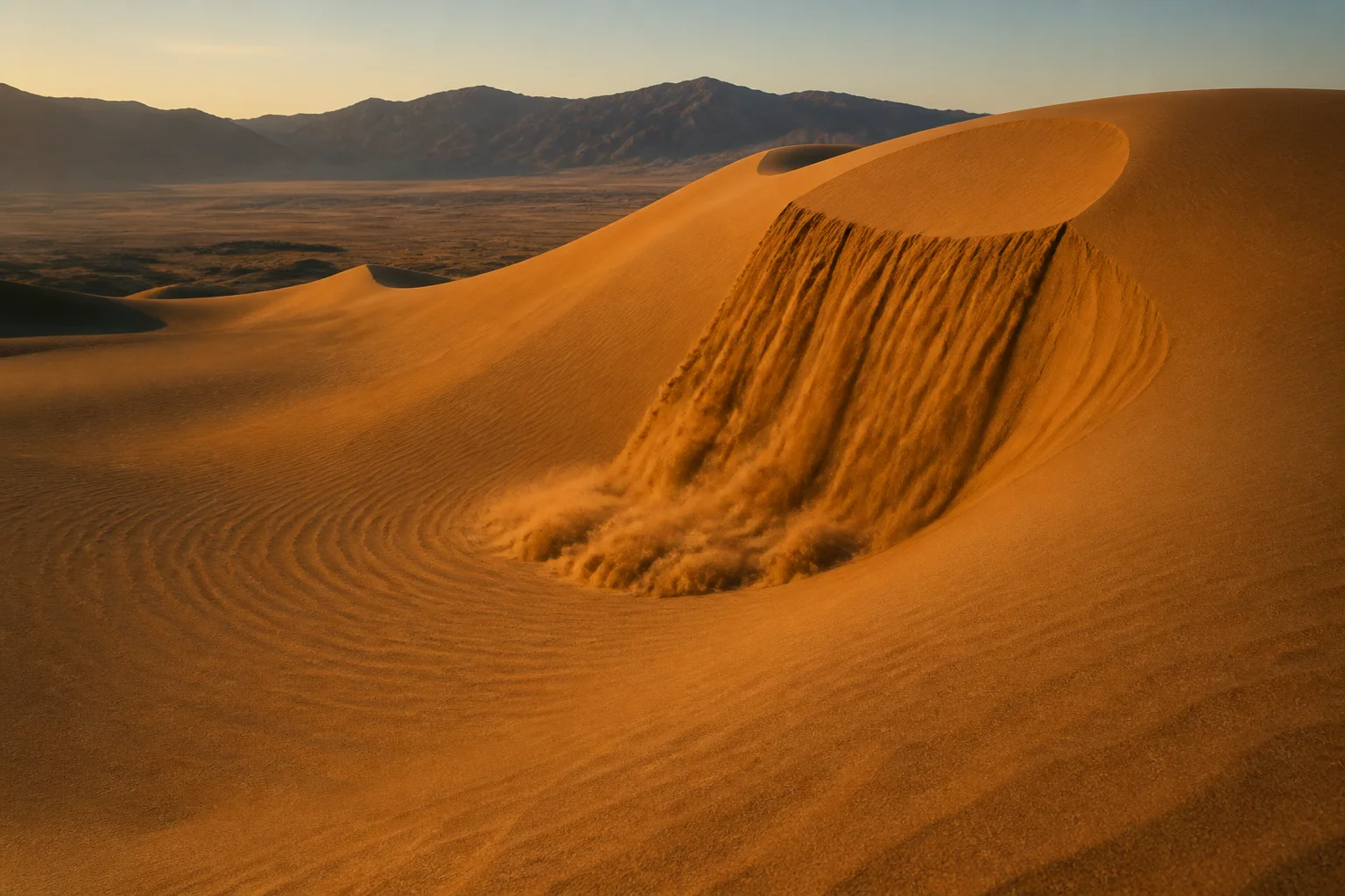
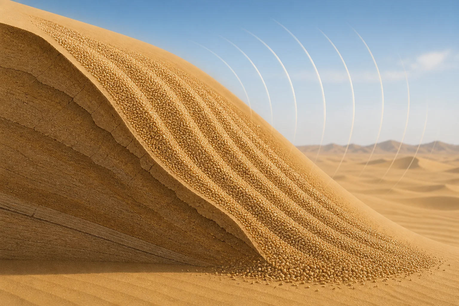
    A warm-lit desert dune sends a sheet of sand down its steep slip face
    Editorial illustration: a sand avalanche moving down a steep dune slip face.

    The concert begins with an avalanche

    A booming dune is not singing because wind is blowing across its crest like air across a bottle. The trigger is a granular avalanche: a layer of sand loses its footing and flows down the dune’s steep “slip face.” The National Park Service describes the sound at Great Sand Dunes as a deep hum produced as air is pushed through millions of tumbling grains.

    That description helps explain why the effect is so selective. A dune needs a particular combination of material and conditions. Research on singing sand has found that the grains are typically dry and fairly well sorted, so a large population of similarly sized grains can move together. Dampness, mixed grain sizes, or an avalanche that is too small or too disorganized can leave the slope silent.

    The result can be surprisingly low. A field study of booming dunes reported a dominant audible frequency in roughly the 70-to-105-hertz range, accompanied by higher harmonics. That is bass territory: low enough to feel as a vibration in the body as well as hear as a tone.

    Rounded sand grains descend a dune slip face in synchronized flowing bands
    Editorial illustration: the moving layer where sand grains flow and interact.

    What the experiments actually show

    One influential 2006 study compared several booming dunes with controlled avalanches in the laboratory and field. Its authors concluded that the sound’s frequency matches the relative motion of the grains, and that the moving grains can synchronize their motion. In that picture, millions of tiny contacts cooperate long enough to produce one audible note instead of a heap of unrelated clicks.

    That does not mean every sand grain is acting like a miniature tuning fork. The important behavior is collective. As grains slide, collide, and shear past one another, their movement can lock into a repeating pattern. The avalanche becomes a self-organized source of vibration, with the surrounding air carrying that vibration to a listener.

    But “the grains synchronize” is not the end of the story. A 2012 study in Geophysical Research Letters tested singing-dune sand in laboratory avalanches over a hard plate. The researchers found that the sand could sing without a dune underneath it—and therefore without the dune’s internal layers acting as a required resonator. They also found that well-sorted grains produced a clearer frequency than polydisperse sand.

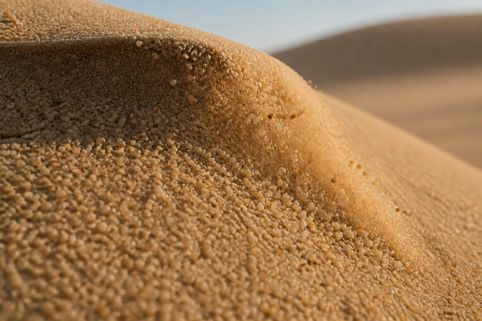
    Rounded desert sand grains slide over a small ridge in warm side light
    Editorial illustration: the rounded, closely packed grains that make a flowing sand layer audible.

    A real phenomenon with an unfinished explanation

    Another field study reached a different emphasis. It proposed that a thin layer of dry, loose sand near the surface can act as a natural waveguide, helping set the booming frequency as vibrations reflect through the dune. This does not erase the evidence for grain-scale synchronization; it highlights a different part of the system that may shape the sound people hear.

    The careful conclusion is therefore narrower—and more interesting—than “scientists solved the singing dune.” Researchers agree on the observable sequence: suitable dry grains, a flowing avalanche, and a loud, sustained sound with a recognizable frequency. They continue to debate exactly how the moving grains, the shallow surface layer, and the surrounding dune couple together to produce and amplify that note.

    That uncertainty is not a weakness in the evidence. It is a reminder that a familiar material can behave like a complicated instrument when enough of it moves together. The dune does not contain a hidden organ, and it is not making music in the human sense. It is a landscape-scale granular flow that briefly finds a rhythm.

    Listen carefully, leave the sand where it is

    The National Park Service describes booming or singing sand as a natural sound worth listening for, and warns visitors to respect the dune environment. Dune fields are protected landscapes with fragile surfaces and specialized plants and insects. The safest way to experience the phenomenon is to follow the preserve’s current guidance, avoid dangerous slopes and hot conditions, and treat the sound as a rare event rather than a performance that must be forced.

    When the conditions line up, the desert can seem to have found a single enormous note. The strange part is not that sand can move. It is that grains with no instrument, strings, or voice box can move together closely enough for the whole slope to hum.

    Sources

  • The Rocks That Take a Walk Across Death Valley

    The Rocks That Take a Walk Across Death Valley

    WEIRD, BUT TRUE

    The Rocks That Take a Walk Across Death Valley

    At Racetrack Playa, visitors find stones at the ends of long trails. The trick behind the “sailing stones” is real, rare, and wonderfully ordinary: a little water, a little ice, and a little wind.

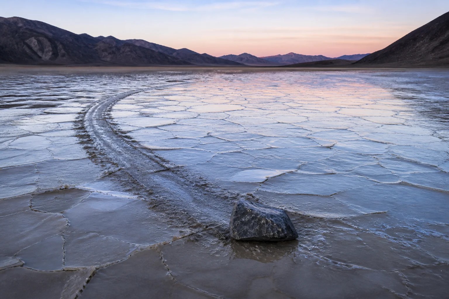
    Imagine arriving at a dry lakebed and discovering that a rock has apparently gone for a stroll. There are no footprints around it, no tire tracks, and no helpful witness pointing toward the culprit. Only a long groove in the mud, sometimes bending gently across the pale floor.

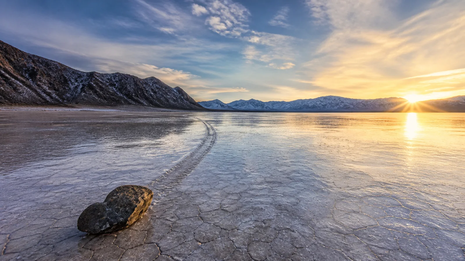
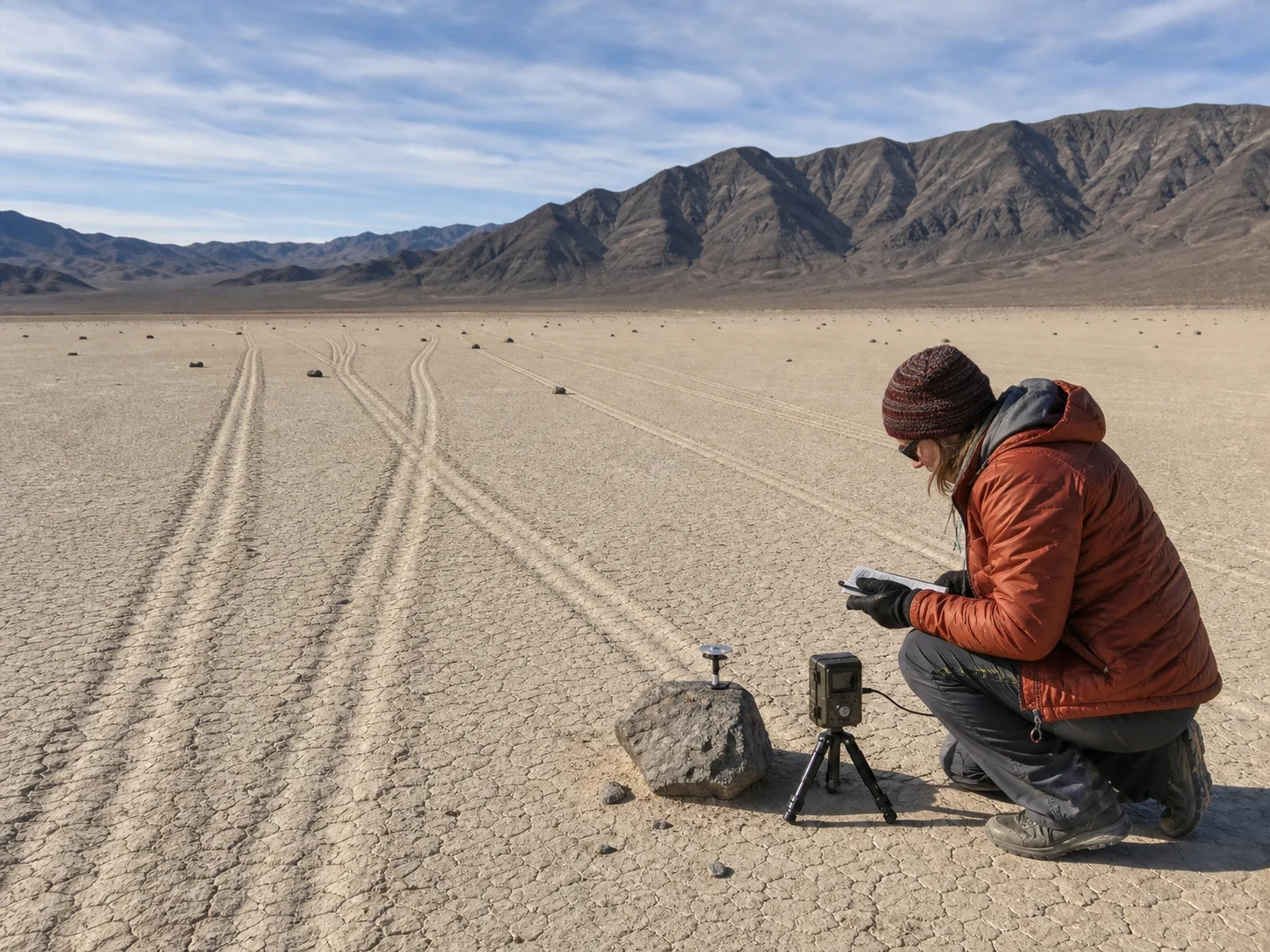
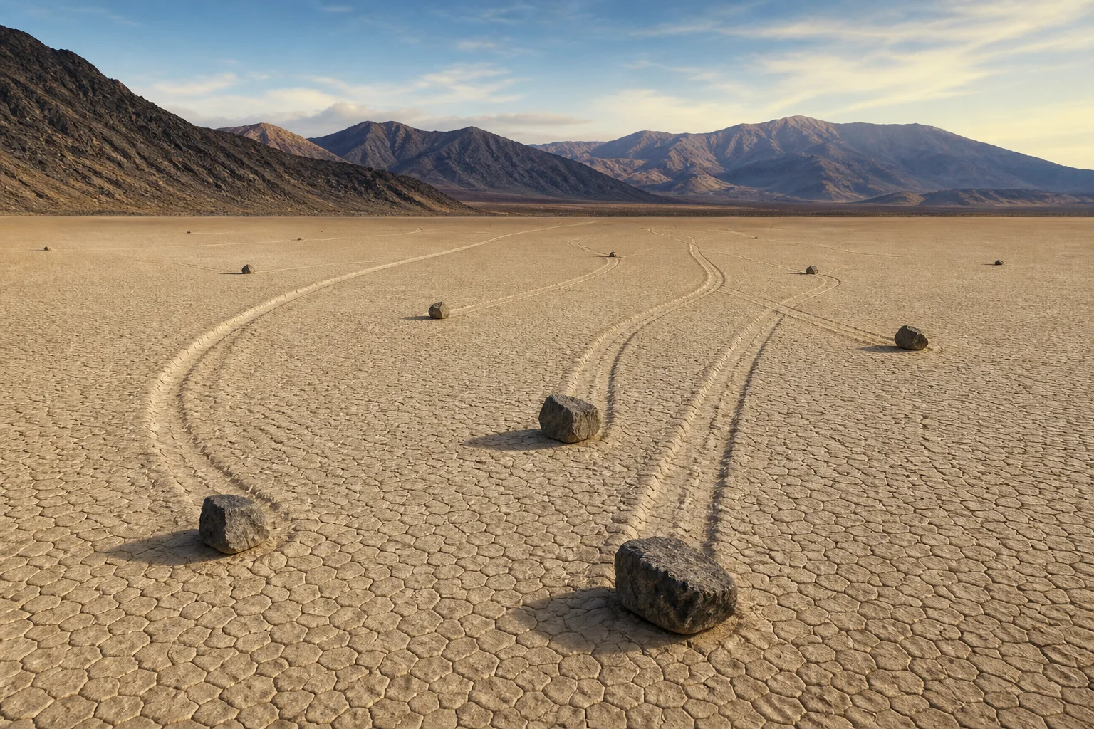
    That is the signature oddity of Racetrack Playa, a nearly level dry lake in a remote part of California’s Death Valley National Park. Stones scattered across the playa leave tracks that can run for hundreds of meters. The National Park Service says some rocks have traveled as far as 1,500 feet, while the stones themselves can weigh hundreds of pounds.

    The fact: the rocks really move

    For decades, the movement was inferred from the trails rather than watched. The playa is so remote, and the right weather so infrequent, that a person could spend a long time waiting for a performance that lasts only minutes.

    That changed during a field project in the winter of 2013–14. Researchers Richard and James Norris, Ralph Lorenz, Jib Ray, and Brian Jackson placed GPS units on selected stones, set up time-lapse cameras, and monitored the weather. Their open-access study reports a largest observed event involving more than 60 rocks. Some instrumented rocks moved as far as 224 meters over several events.

    The movement was slow enough to be easy to miss at a distance: roughly 2–5 meters per minute in the observed events. The rocks did not leap, roll dramatically, or glide through a supernatural force field. They were pushed along the wet surface by broad panels of floating ice.

    A thin ice panel nudging a dark stone across shallow water and wet mud
    Editorial illustration: a thin ice panel nudges a stone across shallow playa water.

    The mechanism: a desert’s tiny winter pond

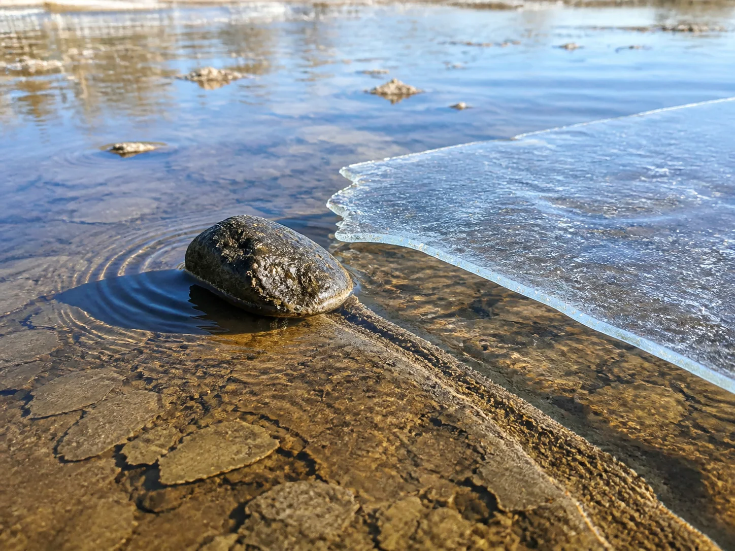
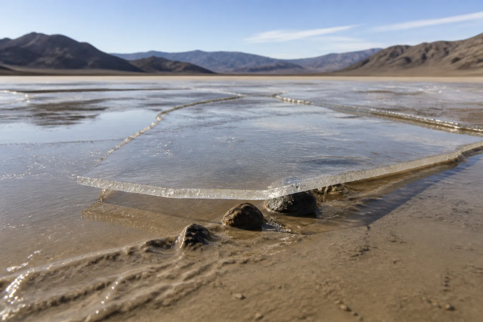
    Racetrack Playa is usually dry, but winter rain or snow can briefly create a shallow pond. When night temperatures fall, the water can freeze into a sheet only a few millimeters thick. The study describes this as “windowpane” ice: thin, broad, and strong enough to form panels when it breaks up.

    As sunlight warms the pond, the ice fractures. Light winds then move the floating panels across the water. When a panel meets a stone, it can push that stone over the soft, slick mud below. The water reduces friction; the ice supplies a broad surface for the wind to push. A track remains when the pond drains and the mud dries.

    This explains why neighboring rocks can draw parallel lines and why some stones move while others stay put. Position, shape, water depth, ice breakup, and wind direction all matter. The researchers observed panels tens of meters wide moving rocks in winds of only about 4–5 meters per second—far gentler than the hurricane-force gusts once proposed.

    The folklore: curses, aliens, and invisible helpers

    Before anyone caught the process on camera, the trails invited stories. People proposed powerful winds, thick ice, slippery algae, seismic vibrations, and other explanations. Modern visitors sometimes add extraterrestrials or a desert curse to the list. Those are folklore and speculation: engaging ways to narrate a mystery, but not evidence for what moves the stones.

    The more satisfying story is the documented one. A remote place made observation difficult; patient researchers brought instruments; and a rare combination of winter conditions finally supplied the missing scene. Mystery did not vanish so much as change shape. The question became less “Who dragged the rock?” and more “How often does this exact little weather machine switch on?”

    A field researcher studying parallel stone trails beside a time-lapse camera on Racetrack Playa
    Editorial illustration: field observation of parallel trails and a GPS-instrumented stone.

    A phenomenon worth leaving alone

    The National Park Service warns that the Racetrack is remote, roads can be rough, and there is no cell service. More importantly, the playa surface is fragile. Driving across it or walking on wet mud can leave scars that last for years, and the rocks are protected natural resources. The best way to meet a sailing stone is to let its trail do the talking.

    So, if you ever stand at the edge of this enormous, quiet floor and see a stone at the end of a fresh-looking groove, you can enjoy both halves of the experience. The track is genuinely strange. The explanation is genuinely true. And somewhere under the right winter sky, a paper-thin sheet of ice may be preparing to give another rock a very slow ride.

    Sources

    1. National Park Service, “The Racetrack” — park geography, trail lengths, visitor guidance, and the observed ice-and-wind explanation.
    2. Norris et al., “Sliding rocks on Racetrack Playa, Death Valley National Park: first observation of rocks in motion,” PLOS ONE (2014) — GPS, time-lapse, weather observations, movement distances, speeds, and ice-panel mechanism.
    3. Open-access article DOI: 10.1371/journal.pone.0105948 — full study and methods.

    All images in this feature are original editorial illustrations generated for WeirdNews.org.

  • The Cave Organ That Turns Stalactites Into a Keyboard

    The Cave Organ That Turns Stalactites Into a Keyboard

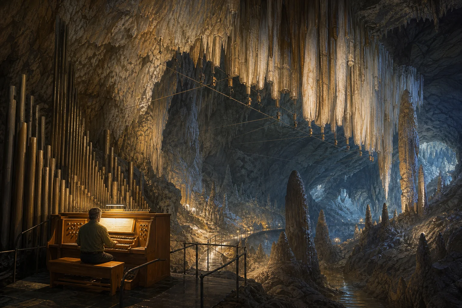
    Deep inside Virginia’s Luray Caverns, a keyboard can make a cave sing. The instrument is real, but its origin story has more than one version.

    Editorial illustration of an organ console and visitor beneath the hanging stone formations of a vast cave
    Editorial illustration: the Great Stalacpipe Organ occupies a network of tuned formations inside Luray Caverns.

    Most keyboards send electricity to speakers. The Great Stalacpipe Organ sends it to rubber-tipped mallets hidden around a cavern, where they tap selected stalactites. The result is a musical instrument whose “pipes” are mineral formations and whose concert hall is the cave itself.

    A strange idea, tested patiently

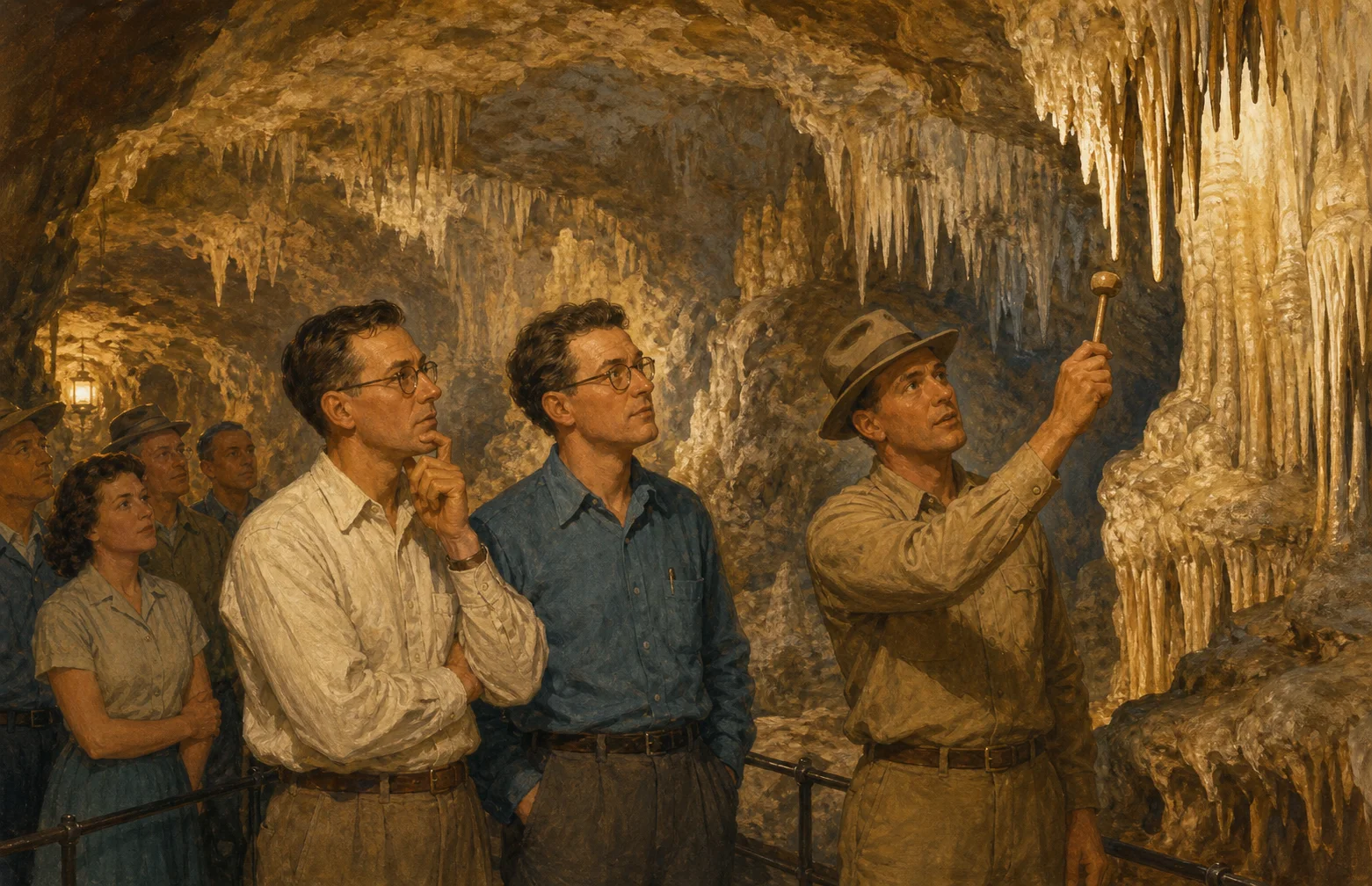
    The documented version of the story begins in 1954. Leland W. Sprinkle, a mathematician and electronics scientist who worked at the Pentagon, visited Luray Caverns in Virginia with his son. Guides then demonstrated the formations by tapping them with a small mallet; different shapes produced different tones. Luray Caverns’ own history says that demonstration gave Sprinkle the idea for a much larger instrument.

    Sprinkle spent the next three years testing formations across more than 3.5 acres of the cave. The cavern’s account says he used 13 English tuning forks while searching for tones, then carefully altered selected stalactites to bring them to pitch. Electrical mallets and wiring connected those formations to a large, four-manual console.

    Editorial illustration of a mid-century cave tour guide tapping a stalactite while a curious visitor listens
    Editorial illustration: a cave-tour demonstration is the documented spark in Luray’s account of Sprinkle’s idea.

    It is not quite a pipe organ

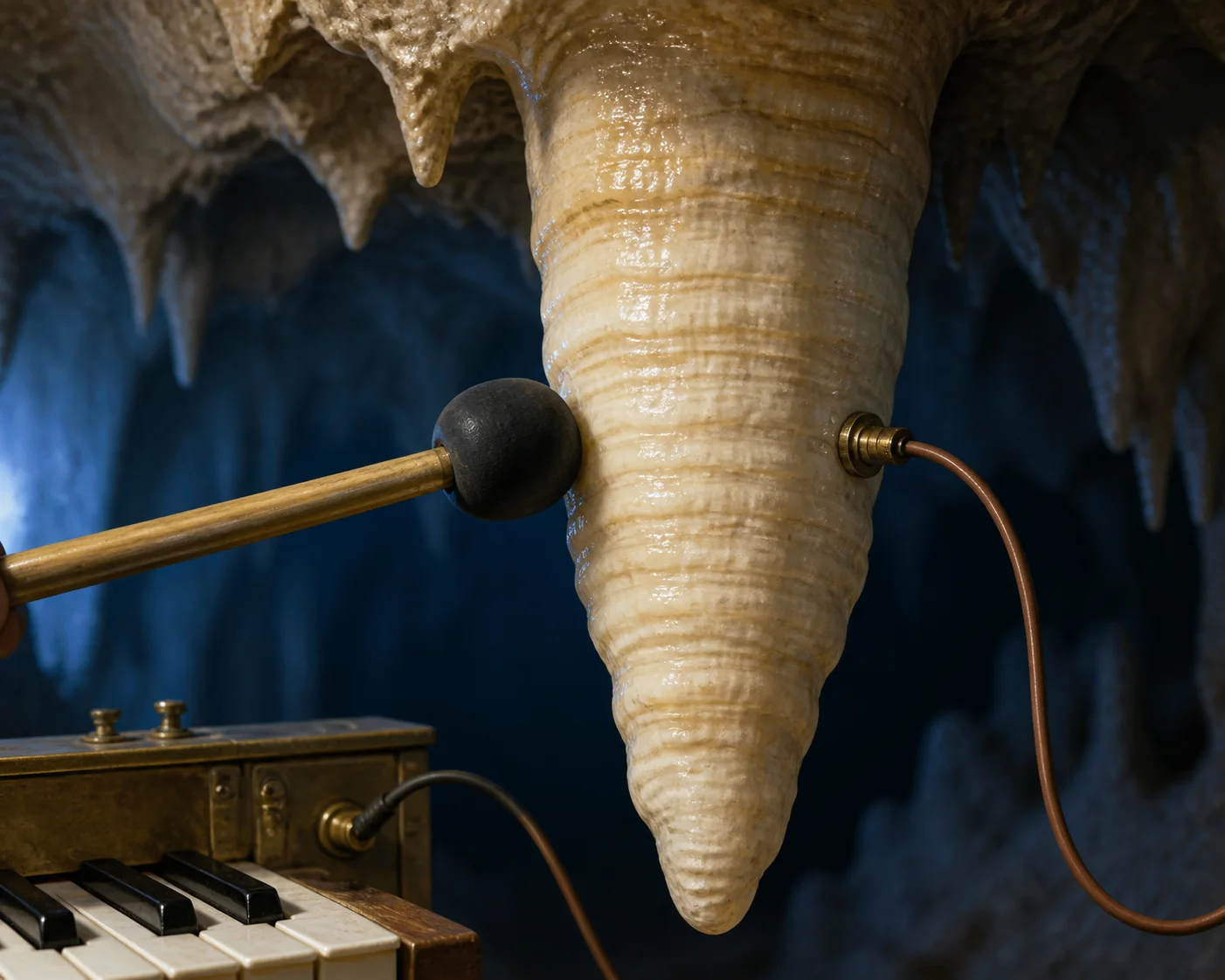
    The name is a playful mash-up of “stalactite” and “pipe organ.” In engineering terms, the Stalacpipe is closer to a giant, electrically actuated lithophone: a keyboard triggers mechanical strikers, and the stone itself vibrates. PBS NewsHour described the working instrument as a 37-note percussion instrument. Luray says the mallets are rubber-tipped plungers, so the formations can sound without a performer taking a hammer to the cave by hand.

    The cavern adds the instrument’s unusual scale. Guinness World Records lists the Great Stalacpipe Organ as the largest natural underground musical instrument, with stalactites covering 1.4 hectares, or about 3.5 acres. That is a measurement of the instrument’s reach through the cave—not a claim that the organ is the world’s largest conventional pipe organ. Guinness maintains separate records for conventional organs, an important distinction when a superlative is doing a lot of work in a headline.

    Editorial illustration showing a rubber-tipped mallet and wire striking a hanging calcite stalactite
    Editorial illustration: a keyboard signal activates a mallet beside a tuned stalactite.

    What is fact, and what is folklore?

    Confirmed by the strongest available accounts: Sprinkle visited Luray in 1954; he was inspired by the sound of tapped formations; he developed the instrument over three years; electronic mallets connect selected stalactites to an organ-style console; and Guinness records the instrument’s 3.5-acre underground span. Luray also says the organ can still be played manually, although an automated system now plays many public melodies in a player-piano-like fashion.

    Folklore or disputed retelling: later accounts sometimes say Sprinkle’s son struck his head on a low stalactite, and that the accidental note sparked the invention. It is a memorable detail, but it is not the origin story given in Luray’s own account or in the PBS description of the 1954 visit. The careful version is therefore the less cinematic one: a guide demonstrated the cave’s tones, and an observant engineer decided to build a system around them.

    Why the stone can sing

    Stalactites are not hollow pipes waiting for air. They are cave formations built when water dissolves limestone, carries calcium carbonate into an air-filled chamber, and deposits the mineral as the water loses carbon dioxide or evaporates. The National Park Service explains that stalactites hang from cave ceilings and can take thousands of years to form.

    When one of these formations is struck, it can vibrate. Its dimensions and density determine the tone, much as the length and material of a xylophone bar affect its pitch. Sprinkle’s achievement was not making nature obey a mythic musical rule; it was identifying usable tones, shaping some formations with care, and building the electromechanical link that lets a person play them from a keyboard.

    That is why the Great Stalacpipe Organ remains such a satisfying oddity. It is neither a geological miracle that composes by itself nor a conventional organ hidden underground. It is a patient human invention wrapped around very old stone—and a reminder that sometimes the weirdest instrument begins with somebody listening closely to a tour guide.

  • At Minnesota’s Devil’s Kettle, Half a River Vanishes—Then the Numbers Catch Up

    At Minnesota’s Devil’s Kettle, Half a River Vanishes—Then the Numbers Catch Up

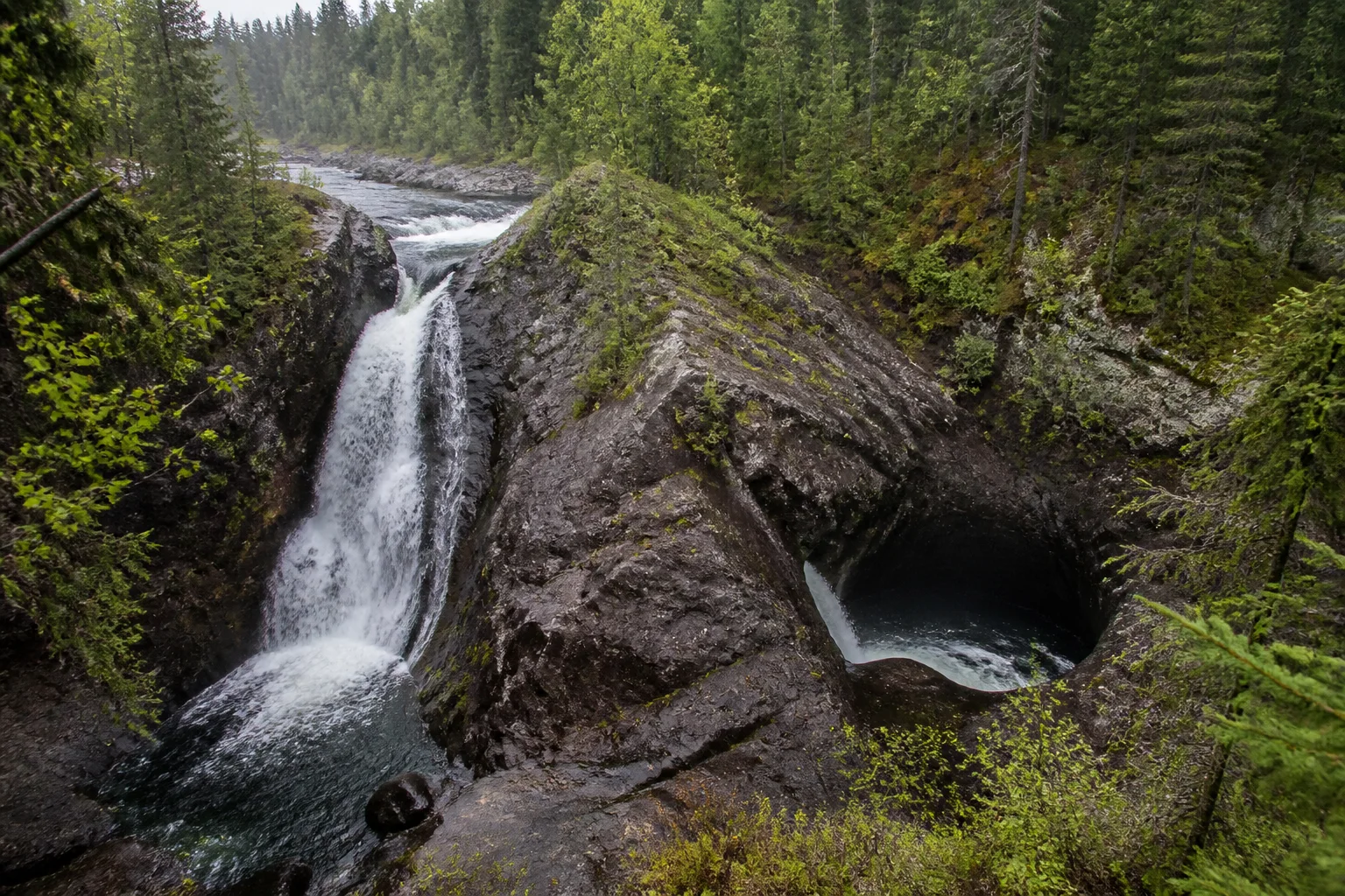
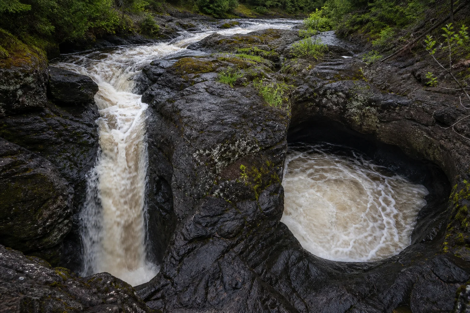
    At first glance, Devil’s Kettle Falls looks like a river with a secret exit. The Brule River reaches a dark volcanic outcrop in northern Minnesota, splits in two, and sends one branch into a pothole that appears to swallow the flow. The odd part is real. The supernatural part is optional.

    The Brule River divides around a dark volcanic rock knob, with one branch falling and the other churning into a pothole
    At Devil’s Kettle, the river’s two branches make the same landscape look like two different kinds of waterfall. Editorial illustration.

    A hike toward a very strange fork

    Devil’s Kettle sits in Judge C.R. Magney State Park, on Minnesota’s North Shore near Grand Marais. The park’s current map describes a one-mile walk along the Brule River, including roughly 175 stairs, to reach the falls. It is a small adventure with a large visual payoff: the river divides around a mass of volcanic rock, and the western branch pours into what the park calls a massive pothole.

    The eastern branch behaves the way visitors expect a waterfall to behave, dropping about 50 feet into a pool. The western branch disappears from view. That vanishing act is why people have long tossed sticks and other buoyant objects into the hole, hoping to see them reappear farther down the river.

    Devil’s Kettle Falls in a forested Minnesota gorge, with a waterfall beside a dark circular pothole
    The natural setting is dramatic enough without adding a portal: wet rhyolite, whitewater and boreal forest do the work. Editorial illustration.

    The two numbers that changed the story

    For years, the most tempting explanation was that the missing water took a hidden route all the way to Lake Superior. That is folklore and speculation, not a demonstrated destination. Minnesota DNR geologists also noted that the North Shore’s hard volcanic rocks do not readily form the kind of broad limestone cave systems people often imagine.

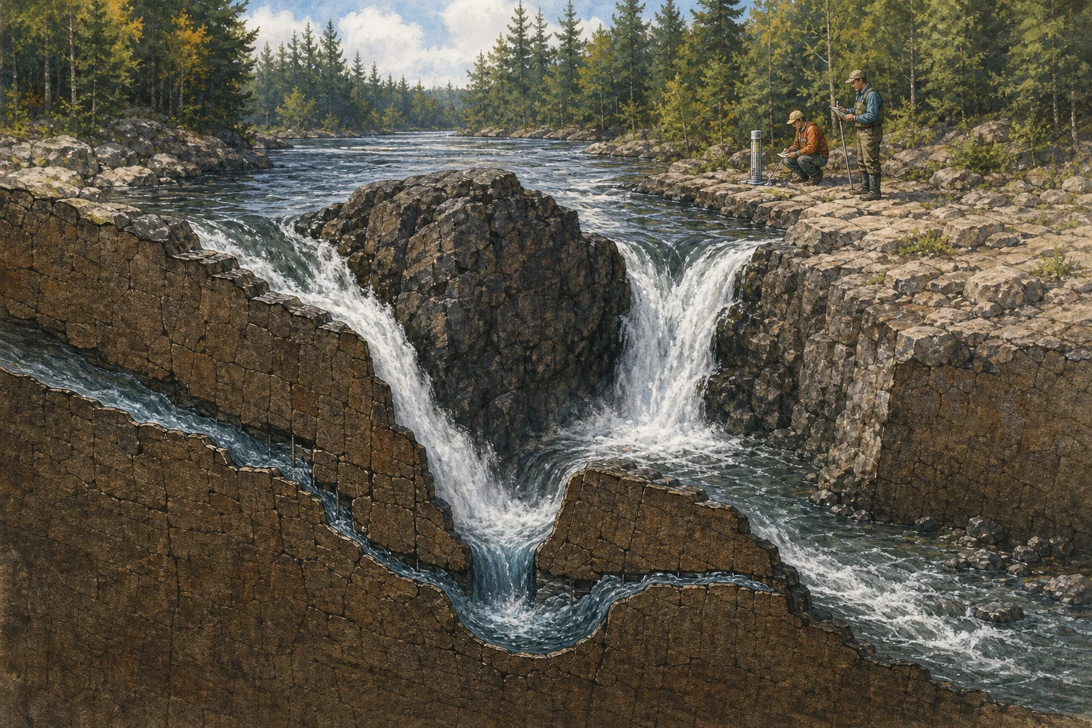
    Then hydrologists tested the question in a less cinematic way: they measured flow. In late fall 2016, the Minnesota Department of Natural Resources recorded 123 cubic feet per second above the falls and 121 cubic feet per second several hundred feet below them. The DNR says those readings are essentially the same within the equipment’s tolerances. In other words, the water had not left the river system between the two gauges.

    That is the confirmed answer to the big question: the water that drops into Devil’s Kettle resurges in the Brule River downstream. It is not an underground highway to a distant lake. The DNR’s account does not identify a single visible outlet or map every foot of the underground path, so “the water comes back downstream” is more precise than pretending the exact route is fully charted.

    Why the sticks never made a triumphant return

    The disappearing objects are a separate puzzle. The DNR’s hydrology explanation is that the plunge pool contains powerful recirculating currents. Water can hold an object below the surface, grind it against rock or break it apart before material resurfaces downstream. A stick failing to pop out beside the next footbridge is therefore not evidence of a bottomless hole.

    Field hydrologists measure flow near a split river and a volcanic pothole in a natural-history cutaway illustration
    Hydrologists can solve a disappearing-water question by comparing flow above and below the falls; the precise underground route remains a finer-grained geology question. Editorial illustration.

    What is fact, what is folklore?

    • Documented: the Brule River splits at a volcanic outcrop; one branch drops about 50 feet and the other enters a pothole; the park sits within a roughly 1.1-billion-year-old volcanic landscape.
    • Measured: DNR gauges found nearly matching flow above and below Devil’s Kettle in 2016.
    • Explained, but not point-by-point mapped: the missing branch resurges in the river downstream, while recirculating currents help explain why tossed objects are not obvious afterward.
    • Folklore/speculation: stories that the water travels through a secret tunnel to Lake Superior, or that the pothole is bottomless.

    That distinction is the charm of Devil’s Kettle. A person standing at the overlook can still feel the old mystery: half a river really does vanish. The satisfying answer is simply more interesting than a portal. Ancient volcanic rock, turbulent water and a pair of nearly identical measurements are enough to make a perfectly ordinary river look impossible for a minute.

    Sources: Minnesota DNR, “Scientists Solve Geological Puzzle”; Minnesota DNR, “Hydrologists solve mystery of Devil’s Kettle waterfall”; Minnesota DNR, Judge C.R. Magney State Park virtual tour; Minnesota DNR, Judge C.R. Magney State Park map and guide; Smithsonian Magazine, “The Mystery of Minnesota’s Disappearing River”.

  • The Two-Minute Flight That Keeps Two Orkney Islands Connected

    The Two-Minute Flight That Keeps Two Orkney Islands Connected

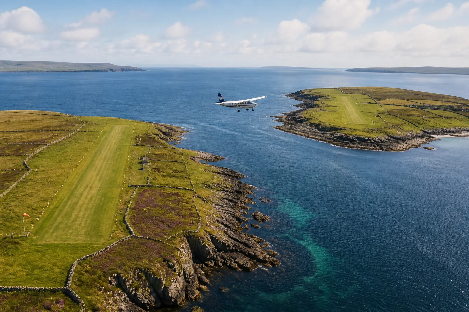
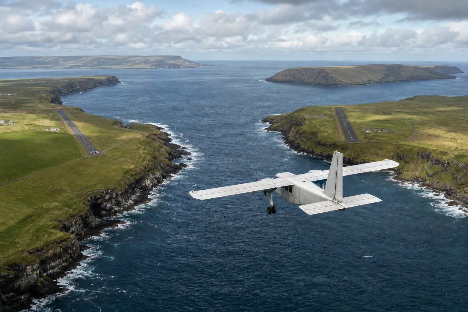
    On a map, Westray and Papa Westray look close enough to wave across the water. In the timetable, they are joined by a scheduled flight that can be over before a kettle boils.

    A small island aircraft flying between two green Orkney islands and their coastal runways
    Editorial illustration: a small aircraft crosses the narrow channel between Orkney’s Westray and Papa Westray.

    The hop between the two Scottish islands is widely recognized as the world’s shortest domestic scheduled flight. Guinness World Records lists the route at 2.74 kilometers (1.7 miles), with a scheduled time of two minutes including taxiing. Loganair, the airline operating Orkney’s inter-island service, says the sector usually takes about 90 seconds.

    Those numbers make the route sound like an aviation punchline. It is also ordinary public transport for people who live there. The flight is part of Orkney’s inter-island network, a Public Service Obligation service operated under contract with Orkney Islands Council. The council describes the flights to the outer North Isles as essential links for communities that cannot be served commercially.

    A flight shorter than most airport routines

    The route is flown in a Britten-Norman Islander, a compact aircraft with room for eight people, seven of them passengers. There is no long climb into the sky. After takeoff from one island, the aircraft crosses a narrow stretch of sea and lines up with the other island’s runway.

    A compact island aircraft approaching a short runway across a narrow channel in Orkney
    Editorial illustration: the two airports sit on neighboring islands separated by a short sea crossing.

    The exact time varies with wind, the aircraft’s movement on the ground and the day’s route. A timetable can call the journey two minutes even when the airborne portion is closer to a minute and a half. Guinness records an especially fast 53-second run reported by Loganair, but that is a record anecdote, not the normal promise made to passengers.

    There is another detail that makes the “flight” unusual: this is not a shuttle that endlessly loops between two airports. The Westray–Papa Westray sector operates when the scheduled inter-island service needs to call at both islands. A passenger must board on one island and leave the aircraft on the other.

    Why a tiny route matters

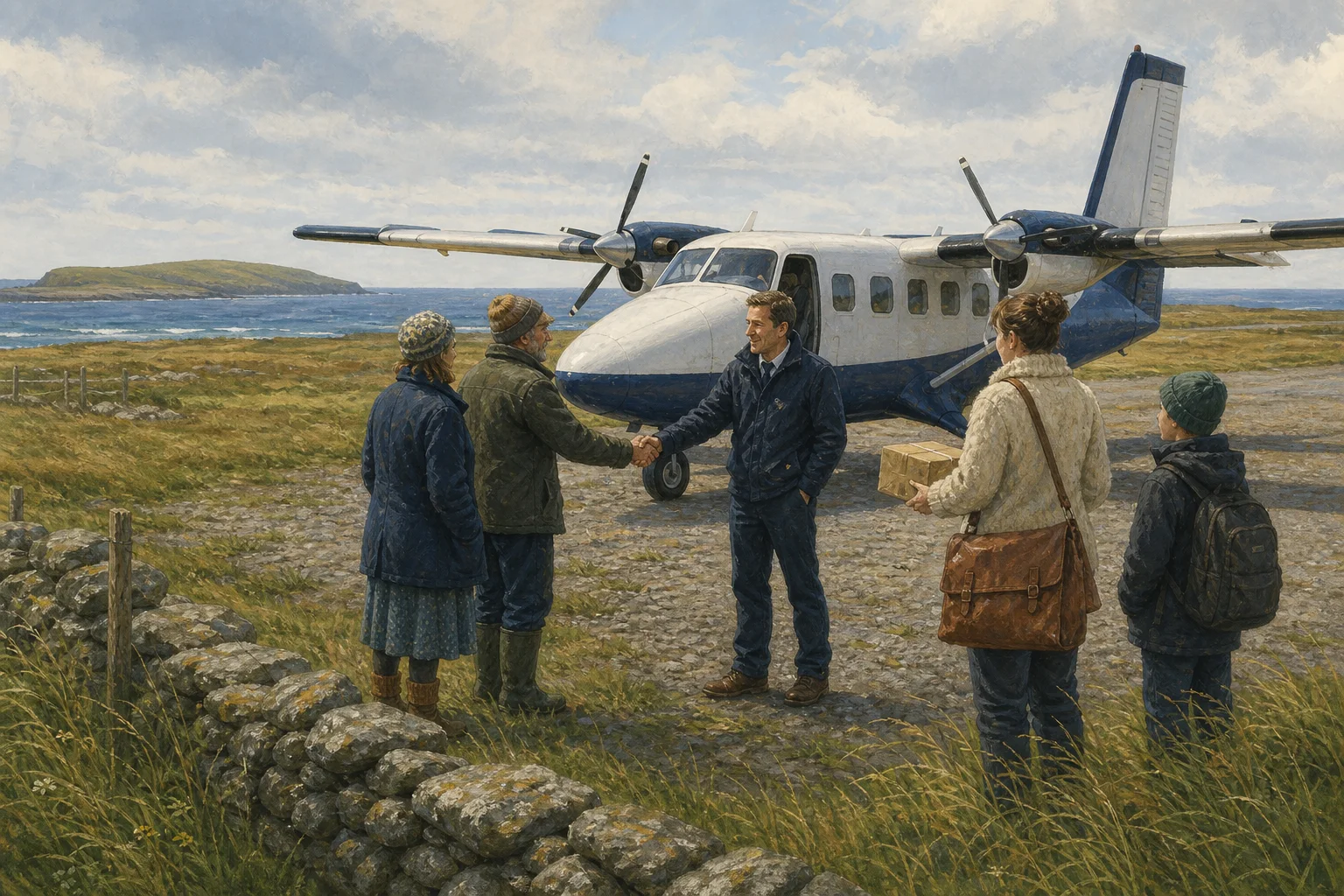
    Orkney’s outer islands are separated from the mainland and from one another by water, weather and limited transport options. The council’s current service description lists education, healthcare, work, shopping and other essential appointments among the everyday reasons residents use the flights. Loganair also says the inter-island service helps deliver mail and other essential services.

    A pilot greeting island residents beside a compact aircraft while a parcel is handed over
    Editorial illustration: the same aircraft that sets a record also supports practical island connections.

    That dual identity is the strange part. Visitors may book the sector for the novelty of taking the shortest scheduled flight, sometimes receiving a certificate from the local tourism association. For islanders, the aircraft is part of a transportation system shaped around real needs. The route’s record status draws attention; its continued public funding reflects geography.

    A record with a long memory

    Orkney’s inter-island air service began in 1967, and Loganair says it has maintained the links ever since. The service has changed aircraft, timetables and booking systems, but the underlying problem is familiar: small communities need reliable ways to reach one another and the mainland.

    So the world’s shortest scheduled flight is best understood in two ways at once. It is a wonderfully odd measurement of distance, and it is a working piece of infrastructure. A journey that lasts about as long as a song chorus can carry a resident to school, a visitor to another island or a parcel toward its destination. The weirdness is real—but so is the reason the flight exists.

    Sources: Orkney Islands Council: Internal Air Services; Orkney Islands Council: Loganair to continue operation of lifeline service; Loganair: Orkney Inter-Isles Flights; Guinness World Records: Shortest domestic scheduled flight; Westray & Papa Westray Tourist Association.

  • How Death Valley’s ‘Moving Rocks’ Actually Move

    How Death Valley’s ‘Moving Rocks’ Actually Move

    Editorial illustration

    At Racetrack Playa in Death Valley National Park, dark rocks have left long, ruled-looking trails across a nearly level dry lakebed. The sight is genuinely odd. It is also not a trick of photography, a prank, or a supernatural claim: field researchers directly watched rocks move there in December 2013 and January 2014.

    Confirmed facts

    The Racetrack is a playa, or dry lakebed, in a remote part of Death Valley National Park. Rocks fall from the surrounding terrain onto its surface, and some later slide across the flat mud, leaving furrows behind. The National Park Service says some rocks weigh as much as 320 kilograms (700 pounds) and that trails can extend for hundreds of meters.

    For decades, the important missing piece was an eyewitness record of the process. A team led by Scripps Institution of Oceanography installed a weather station, time-lapse cameras, and GPS-equipped substitute rocks with park permission. During a rare shallow winter pond, they observed the motion itself.

    The sequence was surprisingly gentle. Cold nights formed a thin, 3-to-6-millimeter sheet of “windowpane” ice over the water. Late-morning sun broke that sheet into floating panels. Light winds, measured at roughly 4 to 5 meters per second, pushed the panels; the panels in turn nudged rocks over slick mud. The rocks moved slowly—about 2 to 5 meters per minute—and more than 60 moved during one observed event. That is why a visitor standing far away could easily miss the action.

    Editorial illustration of a thin ice panel pressing small dark rocks across wet playa mud.
    Editorial illustration

    What was once speculation

    Before those observations, the trails were real but the mechanism was unobserved. Researchers considered powerful wind, liquid water, thick ice, and ice flotation. The 2014 observations did not support the dramatic version in which thick ice lifts a boulder and a gale carries it away. Instead, thin moving ice panels plus modest wind supplied the push.

    That result should not be stretched beyond the evidence. It documents a mechanism for the events the team witnessed; it does not prove that every trail ever made at the Racetrack followed an identical sequence. The Park Service also notes that the researchers had not watched the biggest rocks move. The best-supported conclusion is specific and strange enough on its own: under a rare combination of shallow water, freezing nights, breaking ice, soft mud, and wind, rocks can slide.

    Folklore, mystery language, and the record

    The “mysterious moving rocks” label is part of the place’s public story, and the Park Service itself uses that phrase. But mystery language is not evidence of a documented local legend. The Park Service, USGS, and the peer-reviewed study describe a long scientific puzzle rather than an established folklore tradition of spirits, aliens, magnets, or secret machinery. Such explanations circulate as modern speculation; this feature does not present them as local history.

    There is a smaller, practical lesson in the solved mystery. Tracks and the playa surface are fragile. The Park Service asks visitors not to move or remove rocks, drive on the playa, or walk on muddy areas, where footprints can remain for years. The strange part of the Racetrack needs no embellishment—and it needs careful treatment to remain visible.

    Editorial illustration of dark rocks and shallow trails across a broad cracked desert playa.
    Editorial illustration

    Sources

  • Why U.S. Mail Still Travels by Mule to Supai

    Why U.S. Mail Still Travels by Mule to Supai

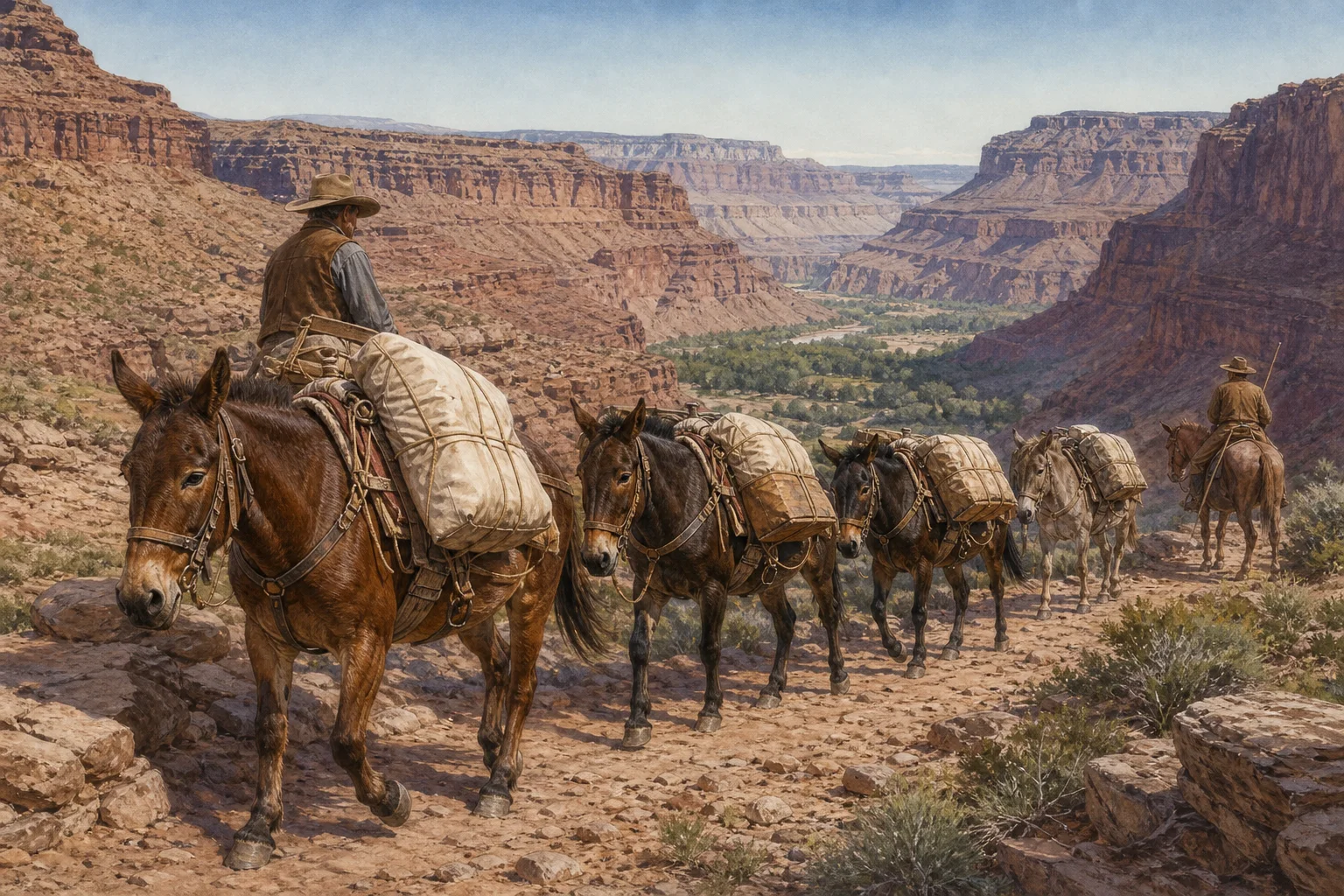
    Editorial illustration of a mule train carrying balanced mail sacks and supplies along a rocky canyon trail toward a green oasis.

    Editorial illustration: a working mule train on a canyon route.

    Most mail reaches a post office in a truck. Mail for Supai, Arizona, still has a final stretch that is much older: it goes down a canyon trail on the backs of mules.

    The United States Postal Service says mules have carried mail and goods to the Havasupai people since the 1930s. Its current Postal Facts page describes a weekday delivery using 10 to 22 mules and a wrangler on horseback, travelling nine miles down to the Supai Post Office. The agency says the descent takes about three hours and the return about five.

    A route shaped by geography

    Supai is in Havasu Canyon, a tributary on the south side of the Colorado River. The National Park Service says the village is not accessible by road, and that the Havasupai Tribe administers the reservation outside Grand Canyon National Park’s boundary and jurisdiction. That distinction matters: the canyon’s geography explains the route, but the community and its land are not a park attraction.

    For visitors, the Park Service lists an eight-mile hike from Hualapai Hilltop to Supai. USPS describes its delivery run as nine miles. Rather than turn the small difference into a mystery, this feature keeps each number with the agency that gives it: the Park Service’s visitor route and the Postal Service’s working delivery route are not presented as the same measurement.

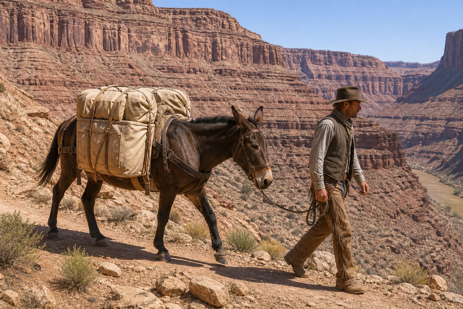
    USPS says each mule can carry up to 200 pounds, with weight divided between both sides for balance. The train carries more than letters and packages: the Postal Service also describes it as carrying goods. Outgoing mail travels back up the canyon, so this is a two-way postal link rather than a ceremonial one-way delivery.

    Editorial illustration of a pack mule with evenly balanced canvas loads walking beside a wrangler on a desert canyon trail.

    Editorial illustration: balanced loads on a working pack mule.

    Why the mules are still there

    The oddity is not that a modern post office somehow forgot about roads. It is that the route has a roadless destination. A mule train can use the canyon trail without turning a remote community’s connection to the mail into a reason to build a road through it.

    USPS has called the Supai service its most unusual delivery method. Its postal-history material has also described the route as the nation’s last mule-train delivery. Those are agency characterizations of a real, continuing service—not evidence for a larger frontier myth. The useful verified facts are narrower: there is an operating Supai Post Office, the community lacks road access, and USPS says a mule train carries its mail and goods on the canyon route.

    Fact, folklore, and the limits of the story

    Documented fact: USPS and the National Park Service independently describe the mail service and Supai’s roadless setting. The Postal Service’s current figures for mule count, weekday schedule, travel time, load capacity, and nine-mile delivery run are attributed to USPS rather than treated as independently measured here.

    Folklore and shorthand: Calling the route a living version of the Pony Express can make a tidy headline, but it is only a comparison. The available official sources describe a modern contract delivery service for a present-day community, not a reenactment of a 19th-century system.

    What this feature does not claim: It does not claim that every item destined for Supai arrives only by mule, that the trail is open to casual day visitors, or that the delivery route establishes ownership or jurisdiction over Havasupai land. The verified strange part is enough: a working U.S. post office is still linked to the national mail by a carefully loaded mule train.

    Sources